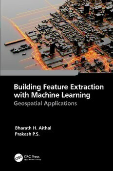
Building Feature Extraction with Machine Learning: Geospatial Applications PDF
Preview Building Feature Extraction with Machine Learning: Geospatial Applications
Building Feature Extraction with Machine Learning Big geospatial datasets created by large infrastructure projects require massive computing resources to process. Feature extraction is a process used to reduce the initial set of raw data for manageable image processing, and machine learning (ML) is the science that supports it. This book focuses on feature extraction methods for optical geospatial data using ML. It is a practical guide for professionals and graduate students starting a career in information extraction. It explains spatial feature extraction in an easy-to-understand way and includes real case studies on how to collect height values for spatial features, how to develop 3D models in a map context, and others. Features • Provides the fundamentals of feature extraction methods and applications along with the fundamentals of machine learning • Discusses in detail the application of machine learning techni- ques in geospatial building feature extraction • Explains the methods for estimating object height from optical satellite remote sensing images using Python • Includes case studies that demonstrate the use of machine learning models for building footprint extraction and photo- grammetric methods for height assessment • Highlights the potential of machine learning and geospatial technology for future project developments This book will be of interest to professionals, researchers, and graduate students in geoscience and earth observation, machine learning and data science, civil engineers, and urban planners. Building Feature Extraction with Machine Learning Geospatial Applications Bharath H. Aithal and Prakash P.S. First edition published 2023 by CRC Press 6000 Broken Sound Parkway NW, Suite 300, Boca Raton, FL 33487-2742 and by CRC Press 4 Park Square, Milton Park, Abingdon, Oxon, OX14 4RN CRC Press is an imprint of Taylor & Francis Group, LLC © 2023 Bharath H. Aithal and Prakash P.S. Reasonable efforts have been made to publish reliable data and information, but the author and publisher cannot assume responsibility for the validity of all materials or the consequences of their use. The authors and publishers have attempted to trace the copyright holders of all material reproduced in this publication and apologize to copyright holders if permission to publish in this form has not been obtained. If any copyright material has not been acknowledged please write and let us know so we may rectify in any future reprint. Except as permitted under U.S. Copyright Law, no part of this book may be reprinted, reproduced, transmitted, or utilized in any form by any electronic, mechanical, or other means, now known or hereafter invented, including photocopying, microfilming, and recording, or in any information storage or retrieval system, without written permission from the publishers. For permission to photocopy or use material electronically from this work, access www. copyright.com or contact the Copyright Clearance Center, Inc. (CCC), 222 Rosewood Drive, Danvers, MA 01923, 978-750-8400. For works that are not available on CCC please contact mpkbookspermissions@tandf.co.uk Trademark notice: Product or corporate names may be trademarks or registered trademarks and are used only for identification and explanation without intent to infringe. ISBN: 978-1-032-25533-0 (hbk) ISBN: 978-1-032-26383-0 (pbk) ISBN: 978-1-003-28804-6 (ebk) DOI: 10.1201/9781003288046 Typeset in Times by MPS Limited, Dehradun Dedication To all geospatial application enthusiasts out there Contents Preface......................................................................................................xi Acknowledgements................................................................................xiii Authors....................................................................................................xv Chapter 1 Introduction.........................................................................1 1.1 Geospatial Technologies............................................1 1.2 Feature Extraction......................................................2 1.3 Geospatial Machine Learning....................................3 1.4 Height Estimation......................................................5 1.5 Three-Dimensional Mapping.....................................6 References............................................................................7 Chapter 2 Geospatial Big Data for Machine Learning.......................9 2.1 Geospatial Big Data...................................................9 2.2 Machine Learning Framework for Geospatial Big Data...................................................................11 2.3 Data Sources............................................................13 2.3.1 USGS – NASA’s Mission...........................13 2.3.2 Copernicus Missions....................................15 2.3.3 ISRO Missions.............................................16 2.3.4 Other Missions.............................................17 2.4 The Challenge with EO Data..................................18 2.5 GeoAI Platforms......................................................18 2.6 Choosing the Right Data.........................................20 References..........................................................................27 Chapter 3 Spatial Feature Extraction.................................................33 3.1 Feature Extraction....................................................33 3.2 Machine Learning Models.......................................33 3.2.1 Maximum Likelihood Classifiers................34 3.2.2 Random Forest.............................................35 3.2.3 Naïve Bayes.................................................36 3.2.4 The SVM.....................................................38 3.2.5 Neural Networks..........................................41 3.2.6 Convolutional Neural Networks..................44 3.3 Deep Learning Architecture....................................48 3.4 Model Architecture..................................................51 vii viii Contents 3.4.1 Loss Function..............................................52 3.4.2 Data Augmentation......................................53 3.4.3 Hyperparameters..........................................53 3.4.4 Data Normalization......................................54 3.4.5 Transfer Learning........................................54 3.5 Methods....................................................................54 3.5.1 Image Pre-Processing..................................55 3.5.2 Model Training............................................55 3.5.3 Post-Processing............................................56 3.5.4 Accuracy Evaluation....................................56 3.6 Findings and Conclusions........................................58 References..........................................................................61 Chapter 4 Building Height Estimation..............................................67 4.1 Significance of Building Height..............................67 4.2 Background..............................................................68 4.3 Estimation of Height from Stereo Satellite Images......................................................................70 4.3.1 Stereo Satellite Images................................71 4.3.2 Surface Model Preparation..........................72 4.3.3 DSM Quality Evaluation.............................73 4.3.4 Preparation of a Terrain Model..................74 4.3.4.1 MDS Filtering...............................74 4.3.4.2 Grid-Based Method......................74 4.3.4.3 Interpolation..................................75 4.3.4.4 Slope-Based Filter........................75 4.3.4.5 Road Buffers.................................75 4.4 Estimating the Height of a Building.......................76 4.4.1 DTM Method...............................................76 4.4.2 Buffer Polygons...........................................76 4.5 Height Estimations and Quality Evaluation............77 4.5.1 DSM Quality Evaluation.............................77 4.5.2 DTM Quality Evaluation.............................78 4.5.3 Building Height Values...............................78 4.6 Future Scope of Height Estimations.......................79 References..........................................................................80 Chapter 5 3D Feature Mapping.........................................................83 5.1 3D Mapping from Geospatial Data.........................83 5.2 History of 3D Mapping...........................................84 5.3 Data Standards and Interoperability........................85 Contents ix 5.4 Data Sources for 3D Mapping................................88 5.5 Software Tools for 3D Mapping.............................89 5.6 Experiments..............................................................90 References..........................................................................93 Chapter 6 Application Use Cases......................................................99 6.1 Potential Applications..............................................99 6.2 Case Study #1: Urban Structure Extraction – An Indian Context.................................................100 6.2.1 Study Area.................................................102 6.2.2 Datasets......................................................103 6.2.3 Method.......................................................104 6.2.4 Results and Conclusions...........................104 6.3 Case Study #2: Rooftop Solar Potential Estimation...............................................................106 6.3.1 Solar Radiation..........................................107 6.3.2 UAV or Drone-Captured Imagery............109 6.3.3 Building Roof Extraction..........................110 6.3.4 Shadow Removal.......................................110 6.3.5 Energy Estimations....................................112 6.4 Case Study #3: Assessment of Urban Built-Up Volume...................................................................115 6.4.1 Study Area and Datasets...........................116 6.4.2 Method.......................................................116 6.4.3 DSM Generation........................................117 6.4.4 Built-Up Area Extraction..........................119 6.4.5 Built-Up Volume Estimation....................120 6.4.6 Inference and Conclusions........................121 References........................................................................122 Index.....................................................................................................125
The list of books you might like

The Strength In Our Scars

The Sweetest Oblivion (Made Book 1)

The 48 Laws of Power

$100m Offers
The Batrisini of Sri Lanka (Coleoptera: Staphylinidae: Pselaphinae)
Isis 2006: Vol 97 Index & Table of Contents

DTIC ADA458942: Maintaining the Balance Between Manpower, Skill Levels, and PERSTEMPO

Civilizaciones prehispánicas de América

Greek Government Gazette: Part 1, 2006 no. 137

DTIC ADA454298: Comparison of Gulf of Mexico Wave Information Studies (WIS) 2-G Hindcast with 3-G Hindcasting
ERIC EJ804113: Integrated Reading and Language Arts Instruction

byggforskningsrådet

Børns angst for venepunktur

bühnentauglich?

Right off the Bat by William F Kirk

2006 Social Club Program

c Copyright 2012 Anna Marie Rogers Dixon

Call: 4A2S Class: M/S HP Total Score = 4839663 Absolutely no 10 mete

Is Australia an Asian Country?
Greek Government Gazette: Part 2, 2006 no. 1837

