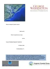
Table Of ContentRemote Sensing for Spatial Analysts
Delivered by
NOAA Coastal Services Center
for the
George Washington Regional Commission
18 March, 2010
Fredericksburg, VA
This project was funded, in part, by the Virginia Coastal Zone Management Program at the
Department of Environmental Quality through Grant #NA 09NOS4190466 of the U.S. Department of
Commerce, National Oceanic and Atmospheric Administration, under the Coastal Zone Management
Act of 1972, as amended. Any views expressed herein are those of the author(s) and do not necessarily
reflect the views of the U.S. Department of Commerce, NOAA, or any of its sub-agencies.
Training Opportunity for GIS Users:
Remote Sensing for Spatial Analysts
This one-day introductory technical
training course offers spatial analysts
in the field of coastal resource
management an opportunity to
understand remote sensing
techniques by providing hands-on
computer training. By the end of the
course, attendees will:
• Understand how remotely sensed data can be used to address coastal resource
management issues,
• Be aware of the benefits and limitations of remote sensing,
• Use remote sensing data in a geographic information system (GIS) environment.
Students will use remote sensing techniques, in combination with spatial data, to
investigate issues such as land cover and change detection. Familiarity with ArcGIS
is required.
Remote Sensing for Spatial Analysts
March 18, 2010
University of Mary Washington, Center for Professional & Graduate Studies
This course is from the training curriculum developed by the National Oceanic and
Atmospheric Administration Coastal Services Center.
Instructor: Shan Burkhalter
Course Outline
GWRC Workshop:
• Land Cover Change and Analysis
• Remote sensing techniques for land cover and change analysis
• Remote sensing techniques for land cover and change analysis
• Image acquisition and processing
• Image difference change detection
• Supervised image classification
• Unsupervised image classification and change analysis
• Post classification change analysis
Additional Training Reference Material:
•Benthic Habitat Mapping
• Management issues and benthic habitat
• Remote sensing of benthic habitat
• Image rectification, transformations and re-sampling
• Aerial photograph rectification
• Principles of photo interpretation and mapping
• Sea grass habitat delineation
• Coastal Ocean Monitoring
• Management issues and coastal ocean remote sensing
• Data availability and formats
• Sea surface temperature
• Extracting SST values and defining temperature habitats
• Ocean color
• Using ocean color imagery to determine monitoring strategies
• Coastal Topographic Applications
• Topographic management issues
• Topography and accuracies
• Methods for measuring topography
• Determining the setback line in a barrier island community
• Comparing topography data for land-use decisions
March 18, 2010
Remote Sensing for Spatial Analysts
Remote Sensing for Spatial Analysts
Instructor introduction
Name and educational background
Remote sensing experience
Student introductions
Name
Organization
Remote sensing experience
Two expectations from this class
GWRC CZM Grant, Task 12.02, Part 1 1
March 18, 2010
Remote Sensing for Spatial Analysts
Overview
– Introduction
– Exercise: Working with Rasters
– Land Cover and Change Analysis
– Exercise: Image Acquisition and Processing
– Exercise: Image Difference Change Detection
– Exercise: Supervised Image Classification
– Exercise: Unsupervised Image Classification and Change Analysis
– Exercise: Post Classification Change Analysis
– Summary
Goals
• Understand the utility
of remote sensing in
coastal applications.
• Recognize the benefits
and limitations of
remote sensing.
• Examine remote
sensing data in a
geographic information
Visible oblique aerial photo, Assateague Island,
system (GIS). Maryland.
GWRC CZM Grant, Task 12.02, Part 1 2
March 18, 2010
A Definition
Remote sensing is the
science of gathering
information from a
distance.
IKONOS multispectral image, April 16, 2001
Nikomaroro Atoll, Republic of Kiribati.
Why Use Remote Sensing?
Remote sensing can
provide
• data in areas not suited to in
situ sampling
• a synoptic, “big-picture” view
• consistency of data
coverage
– in time
– in space
• a backdrop for other data
GWRC CZM Grant, Task 12.02, Part 1 3
March 18, 2010
Sitka Gyre
• Shipboard sampling
– 3 cruises
– 21 days
– $210,000
•Sitka
• 3-hour interval
• 1/2-hour interval
Sitka Gyre
• Shipboard sampling
– 3 cruises
– 21 days
– $210,000
•Sitka
• 3-hour interval
• 1/2-hour interval
GWRC CZM Grant, Task 12.02, Part 1 4
March 18, 2010
Sitka Gyre
• Shipboard sampling
– 3 cruises
– 21 days
– $210,000
•Sitka
• 3-hour interval
• 1/2-hour interval
Coastal Zone Color Scanner,
May 15, 1979
64.
Sitka Gyre
10.
.
• Shipboard sampling
– 3 cruises
– 21 days
1.0
– $210,000
•Sitka
• 3-hour interval
• 1/2-hour interval 0.1
0.0
1
GWRC CZM Grant, Task 12.02, Part 1 5
March 18, 2010
Short-range weather forecasting and
description of current conditions
• Daytime clouds
and sea ice
• Water vapor
• Sea surface
temperature
Short-range weather forecasting and
description of current conditions
• Daytime clouds
and sea ice
• Water vapor
• Sea surface
temperature
GWRC CZM Grant, Task 12.02, Part 1 6
March 18, 2010
Short-range weather forecasting and
description of current conditions
• Daytime clouds
and sea ice
• Water vapor
• Sea surface
temperature
Fundamental Remote Sensing Concepts
• Process
• Sensors
• Platforms
• Orbits
• Spectrums
• Data Structures
• Resolution/Scale
• Rectification
• Trade-offs
SeaWiFS true color image.
GWRC CZM Grant, Task 12.02, Part 1 7

