Table Of ContentGeostatistical Applications for Precision
Agriculture
M.A. Oliver
Editor
Geostatistical Applications
for Precision Agriculture
123
Editor
M.A.Oliver
VisitingProfessorinSoilScience
DepartmentofSoilScience
TheUniversityofReading
Whiteknights,ReadingRG66DW
UnitedKingdom
[email protected]
ISBN978-90-481-9132-1 e-ISBN978-90-481-9133-8
DOI10.1007/978-90-481-9133-8
SpringerDordrechtHeidelbergLondonNewYork
LibraryofCongressControlNumber:2010931684
©SpringerScience+BusinessMediaB.V.2010
Nopartofthisworkmaybereproduced,storedinaretrievalsystem,ortransmittedinanyformorby
anymeans,electronic,mechanical,photocopying,microfilming,recordingorotherwise,withoutwritten
permissionfromthePublisher,withtheexceptionofanymaterialsuppliedspecificallyforthepurpose
ofbeingenteredandexecutedonacomputersystem,forexclusiveusebythepurchaserofthework.
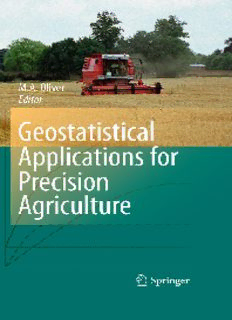
Coverlegend:Harvestingavariable-ratenitrogenexperimentonCashmoreField,Silsoe,England.
PhotographprovidedbySilsoeResearchinstitute.
Printedonacid-freepaper
SpringerispartofSpringerScience+BusinessMedia(www.springer.com)
Preface
Thisbookbringstogethertwodynamicsubjects,precisionagricultureandgeostatis-
tics,thathavespatialvariationattheircore.Geostatisticsisappliedtomanyaspects
of precision agriculture (PA) including sampling, prediction, mapping, decision-
making,variable-rateapplications,economicsandsoon.Contributionsfromexperts
in several fields of study illustrate how geostatistics can and has been used to ad-
vantage with data such as yield, soil, crops, pests, aerial photographs,remote and
proximalimagery.Geostatisticaltechniquesappliedincludevariography,ordinary-,
disjunctive-,factorial-,indicator-,regression-,simple-,space-time-andco-kriging,
andgeostatisticalsimulation.ThisbookwasrequestedbyparticipantsattheSixth
EuropeanConferenceon Precision Agriculturein Skiathos,2007becausethe link
betweengeostatisticsandPAwillincreaseasmoreintensiveinformationonthesoil
andcropsbecomesavailablefromsensorsandon-the-gotechnology.Thisisnota
recipebook,butisintendedtoguidereadersintheuseofappropriatetechniquesfor
thetypesofdataandneedsofthefarmerinmanagingtheland.Allchaptersinclude
oneormorecasestudiestoillustratethetechniques.
Chapter 1 sets the scene for the two main topics of the book. The two core
techniques of geostatistics, variography and kriging, are described, together with
examples of how they can be applied. Sampling for geostatistics is an important
issue because it underpins sound results. Chapter 2 considers the importance of
spatial scale in sampling, the use of ancillary data, a nested survey and existing
variograms of soil or crop properties to guide sampling. Chapter 3 demonstrates
thepotentialtooptimizethedesignofsoilsamplingschemesifthevariationofthe
target property is represented by a linear mixed model. Chapter 4 describes how
calibratedyielddatafrommonitorscanbeusedtotargetcropandsoilinvestigations
and nutrient applications, and for on-farm experiments. This chapter uses spatial
statisticsratherthanonlygeostatisticsbecauseitlendsitselfbettertoeconometrics.
Manyenvironmentalvariablesthatarerelevanttoprecisionagriculture,suchascrop
and soil properties and climate, vary in both time and space; Chapter 5 explains
the basic elements of space-time geostatistics. Chapter 6 providesan overview of
mobile proximal sensors, such as those used to measure apparent soil electrical
conductivity (EC /, and how geostatistics can be used to direct soil sampling to
a
create site-specific managementunits. Three geostatistical methodsto incorporate
secondary information into the mapping of soil and crop attributes to improve
v
vi Preface
the accuracy of their predictions are the topic of Chapter 7. For soil and crop
propertiesthatrequirecostlysamplingandanalysis,thereareofteninsufficientdata
forgeostatisticalanalysesandChapter8showshowmanagementzonescanprovide
an interim solution to more comprehensive site-specific management. Weeds and
plant-parasiticnematodesoccurinpatchesinagriculturalfields;Chapter9describes
howstandardgeostatisticalmethodshavebeenusedsuccessfullytoanalysecounts
of both weed seedlings and nematodes in the soil and to map their distributions
fromkrigedpredictions.Chapter10showshowgeostatisticscanplayanimportant
roleinanalysingexperimentsforsite-specificcropmanagement.Twobroadclasses
of experimental design for precision agriculture (management-class experiments
and local-response experiments) are considered and how each may be analysed
geostatistically. Geostatistical simulation provides a means to mimic the spatial
andortemporalvariationofprocessesthatarerelevanttoprecisionagriculture,and
Chapter11showshowitcanincorporateuncertaintyintomodellingtoobtainamore
realistic impressionof the variation.The bookhasraised severalissues, ideasand
questions,whicharesummarizedinChapter 12.Geostatisticsneedstobe tailored
bettertotheneedsofthevariousgroupsinvolved;farmers,advisorsandresearchers
which have their own particular requirements. The potential for geostatistics and
precisionagriculturefortherestofthetwenty-firstcenturyappearsgreat.
The Appendix gives examples of software that can be used for geostatistical
analyses,andtherearebriefdescriptionsofGenStat,VESPERandSGeMS.
Reading,UnitedKingdom MargaretA.Oliver
Contents
1 AnOverviewofGeostatisticsandPrecisionAgriculture................. 1
M.A.Oliver
1.1 Introduction............................................................. 1
1.1.1 ABriefHistoryofGeostatistics ............................. 2
1.1.2 ABriefHistoryofPrecisionAgriculture.................... 3
1.1.3 ABriefHistoryofGeostatisticsinPrecisionAgriculture.. 6
1.2 TheTheoryofGeostatistics............................................ 7
1.2.1 Stationarity.................................................... 8
1.2.2 TheVariogram................................................ 9
1.2.3 GeostatisticalPrediction:Kriging ........................... 12
1.3 CaseStudy:FootballField............................................. 18
1.3.1 SummaryStatistics ........................................... 19
1.3.2 Variography................................................... 20
1.3.3 Kriging........................................................ 26
1.3.4 Conclusions................................................... 31
References...................................................................... 32
2 SamplinginPrecisionAgriculture.......................................... 35
R.Kerry,M.A.OliverandZ.L.Frogbrook
2.1 Introduction............................................................. 36
2.1.1 TheImportanceofSpatialScaleforSampling.............. 37
2.1.2 HowCanGeostatisticsHelp?................................ 38
2.1.3 HowcantheVariogrambeUsedtoGuideSampling?...... 39
2.2 VariogramstoGuideSampling........................................ 40
2.2.1 NestedSurveyandAnalysis:ReconnaissanceVariogram.. 40
2.2.2 VariogramsfromAncillaryData............................. 43
2.3 UseoftheVariogramtoGuideSamplingforBulking ............... 47
2.3.1 CaseStudy.................................................... 48
2.4 TheVariogramtoGuideGrid-BasedSampling....................... 51
2.4.1 TheVariogramandKrigingEquations...................... 51
2.4.2 HalftheVariogramRange‘RuleofThumb’
asaGuidetoSamplingInterval.............................. 54
vii
viii Contents
2.5 VariogramstoImprovePredictionsfromSparseSampling.......... 55
2.5.1 ResidualMaximumLikelihood(REML)
VariogramEstimator.......................................... 55
2.5.2 StandardizedVariograms..................................... 59
2.6 Conclusions............................................................. 61
References...................................................................... 62
3 Sampling in PrecisionAgriculture,OptimalDesigns
fromUncertainModels ...................................................... 65
B.P.MarchantandR.M.Lark
3.1 Introduction............................................................. 65
3.2 TheLinearMixedModel:Estimation,Predictions
andUncertainty......................................................... 67
3.2.1 TheModel .................................................... 67
3.2.2 Estimation..................................................... 68
3.2.3 Prediction ..................................................... 70
3.2.4 Uncertainty.................................................... 71
3.3 OptimizingSamplingSchemesbySpatial
SimulatedAnnealing................................................... 72
3.3.1 SpatialSimulatedAnnealing................................. 72
3.3.2 ObjectiveFunctionsfromtheLMM......................... 73
3.3.3 OptimizedSampleSchemeforSinglePhase
GeostatisticalSurveys........................................ 77
3.3.4 AdaptiveExploratorySurveystoEstimate
theVariogram................................................. 78
3.4 ACaseStudyinSoilSampling........................................ 81
3.5 Conclusions............................................................. 85
References...................................................................... 86
4 TheSpatialAnalysisofYieldData ......................................... 89
T.W.Griffin
4.1 Introduction............................................................. 89
4.2 BackgroundofSite-SpecificYieldMonitors ......................... 90
4.2.1 ConceptofaYieldMonitor.................................. 93
4.2.2 CalibrationandErrors........................................ 94
4.2.3 CommonUsesofYieldMonitorData....................... 95
4.2.4 ProfitabilityofYieldMonitors............................... 96
4.2.5 QuantityandQualityofProduct............................. 97
4.3 ManagingYieldMonitorData......................................... 97
4.3.1 QualityofYieldMonitorData............................... 97
4.3.2 Challengesin the Use of Yield Data for
DecisionMaking..............................................100
4.3.3 AligningSpatiallyDisparateSpatialDataLayers ..........100
4.4 SpatialStatisticalAnalysisofYieldMonitorData ...................101
4.4.1 ExplicitModellingofSpatialEffects........................101
Contents ix
4.4.2 SpatialInteractionStructure .................................103
4.4.3 Empirical Determination of Spatial
NeighbourhoodStructure ....................................104
4.5 CaseStudy:SpatialAnalysisofYieldMonitorData
fromaField-ScaleExperiment........................................107
4.5.1 CaseStudyData ..............................................107
4.5.2 DataAnalysis.................................................110
4.5.3 CaseStudyResults ...........................................112
4.5.4 CaseStudySummary.........................................112
4.6 Conclusion..............................................................113
References......................................................................113
5 Space–Time Geostatisticsfor PrecisionAgriculture:
ACaseStudyofNDVIMappingforaDutchPotatoField...............117
G.B.M.HeuvelinkandF.M.vanEgmond
5.1 Introduction.............................................................117
5.2 Description of the Lauwersmeer Study Site
andPositionalCorrectionofNDVIData..............................119
5.3 ExploratoryDataAnalysisofLauwersmeerData....................120
5.4 Space–TimeGeostatistics..............................................125
5.4.1 CharacterizationoftheTrend................................126
5.4.2 CharacterizationoftheStochasticResidual.................126
5.5 Application of Space–Time Geostatistics
totheLauwersmeerFarmData........................................128
5.5.1 CharacterizationoftheTrend................................128
5.5.2 CharacterizationoftheStochasticResidual.................130
5.5.3 Space–TimeKriging..........................................131
5.6 DiscussionandConclusions...........................................134
References......................................................................136
6 Delineating Site-Specific Management Units
withProximalSensors .......................................................139
D.L.CorwinandS.M.Lesch
6.1 Introduction.............................................................140
6.1.1 TheNeedforSite-SpecificManagement....................140
6.1.2 DefinitionofSite-SpecificManagementUnit(SSMU).....141
6.1.3 ProximalSensors.............................................141
6.1.4 Objective......................................................144
6.2 DirectedSamplingwithaProximalSensor...........................145
6.2.1 Complexity of Proximal Sensor
MeasurementsandtheRoleofGeostatistics................145
6.2.2 PracticalConsiderationofDifferencesinSupport..........146
6.3 DelineationofSSMUswithaProximalSensor.......................146
6.3.1 GeostatisticalMixedLinearModel..........................146
Description:This book brings together in one place two dynamic subjects, precision agriculture and geostatistics, that have spatial variation at their core. Geostatistics is applied in precision agriculture (PA) to sampling, prediction, mapping, decision-making, economics, designed experiments, variable-rate ap

