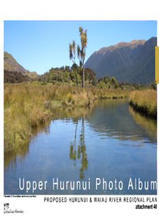
Upper Hurunui Photo Album PDF
Preview Upper Hurunui Photo Album
H U p p e r H u r u n u i P h o t o A l b u m Photo location 12: Channel between Lake Sumner and Loch Katrine P R O P O S E D H U R U N U I & W A I A U R I V E R R E G I O N A L P L A N attachment 46 H attachment 47a Hurunui River upper reaches - Photo locators h c n a r B h t r o N r e p p U H h c n a r B h rt o N attachment 47b H attachment 48a Hurunui River upper reaches - Photo locators H attachment 48b H Photos Hurunui Upper North Branch to Lake Sumner P R O P O S E D H U R U N U I & W A I A U R I V E R R E G I O N A L P L A N *All photos are within ECAN’s proposed Zone C unless stated otherwise Macs Knob Mount Longfellow H Photo location 1: Upper North Branch floodplain & river flats, coalescing fans and isolated mountain. Looking downstream toward Macs Knob and Mount Longfellow. Woolshed Ridge Crawford Range Photo location 2: Landslip Stream Photo location 4: Upper North Branch delta landform. Look- ing downstream to- ward Lake Sumner and Mount Longfellow. Photo location 4: Upper North Branch delta attachment 49 landform. Upper North Branch Flight photographs courtesy of Fish & Game H Photo location 3: Upper North Branch floodplain, fans & river flats and coalescing fans landforms. Looking upstream. Crawford Range. attachment 50 Upper North Branch Flight photograph courtesy of Fish & Game Macs Knob above Photo location 5: Charleys Point Lake Sumner look- ing up Upper North Branch. March 1985 C r a w f o r d N W i H o g o g l e s r h h e e d a d R i d g e Evangeline Stream T h e B r o t h attachment e r 51 s Lake Sumner Conservation Park Photo location 61: Lake Sumner foreshore Photo location 62: Loch Katrine foreshore Photo location 62: Loch Katrine foreshore H Photo location 62: Loch Katrine foreshore Photo location 62: Loch Katrine foreshore Photo location 62: Loch Katrine foreshore P h o t o s H u r u n u i N o r t h B a s i n L a k e s P R O P O S E D H U R U N U I & W A I A U R I V E R R E G I O N A L P L A N attachment 52 *All photos are within ECAN’s proposed Zone C unless stated otherwise
Description: