Town Brook Watershed, New York : 2004-2006 : an ARS benchmark research watershed, one of 24 CEAP watershed projects : CEAP assessment. PDF
Preview Town Brook Watershed, New York : 2004-2006 : an ARS benchmark research watershed, one of 24 CEAP watershed projects : CEAP assessment.
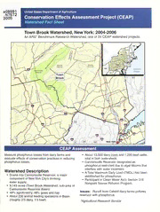
Historic, Archive Document Do not assume content reflects current scientific knowledge, policies, or practices. aGB991 United States Department of Agriculture .N7S72 Conservation Effects Assessment Project (CEAP) 2005 Watershed Fact Sheet Town Brook Watershed, New York: 2004-2006 An ARS* Benchmark Research Watershed, one of 24 CEAP watershed projects. Measure phosphorus losses from dairy farms and • About 13,000 dairy cows and 1,200 beef cattle, evaluate effects of conservation practices in reducing total in both watersheds. phosphorus losses. • Cannonsville Reservoir designated as phosphorus-restricted due to algal blooms that interfere with water treatment. Watershed Description • A Total Maximum Daily Load (TMDL) has been • Drains into Cannonsville Reservoir, a major established for phosphorus. component of New York City’s drinking • Participant in Clean Water Act’s Section 319 water supply. Nonpoint Source Pollution Program. • 9,143 acres (Town Brook Watershed, sub-area of Cannonsville Reservoir Basin) Issues: Runoff from Catskill dairy farms pollutes • 49% agroforestry; 48% grass and hay reservoir with phosphorus. • About 230 animal feeding operations in Basin (roughly 2/3 dairy, 1/3 beef) *Agricultural Research Service Rainfall simulation experimental setup. National Phosphorus Project rainfall simulation equipment. Collaborators • USDA Natural Resources Conservation Service • U.S. Geological Survey • Delaware County Soil and Water Conservation District • Watershed Agricultural Council • New York City Department of Environmental Protection Soil moisture determination at a rainfall simulation site. • New York State Department of Environmental Conservation Approach • Cornell University Cooperative Extension Water Sampling: Phosphorus and sediments • Cornell University Department of Agricultural and Biological Engineering Watershed models: SWAT (Soil and Water Assessment Tool) linked with a best management Contacts practices (BMPs) tool to evaluate expected reductions in phosphorus losses; model will William J. Gburek, Watershed Leader, USDA-ARS identify watershed hot spots where maximum ([email protected]) reductions can be made in phosphorus losses at Gary Lamont, USDA-NRCS minimum cost. (gary.lamont@ ny.usda.gov) Whole farm plans: To date, about 160 of NRCS State Conservationist the animal feeding operations in the Basin are Joseph R. Delvecchio participating in whole-farm planning. Approved BMPs are being installed under a 100% cost-share program supported by New York City. Communicating Results Three annual progress reports. Other reports: quantifying phosphorus reductions by individual BMPs, coupling of chemical and hydrologic processes controlling phosphorus losses to better understand how to control losses, suite of user- friendly indices and models to evaluate effects of BMPs. July 2005 The U.S. Department of Agriculture is an equal opportunity provider and employer. http://www.nrcs.usda.gov/technical/nri/ceap/
