surface water supply protection plan for lily pond and aaron river reservoir PDF
Preview surface water supply protection plan for lily pond and aaron river reservoir
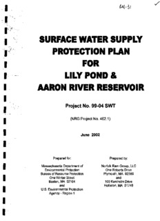
I W-Si I ' . !*>• I SURFACE WATER SUPPLY I PROTECTION PLAN | FOR I LILY POND & I AARON RIVER RESERVOIR I - Project No. 99-04 SWT • (NRG Project No. 462.1) • June 2002 " Prepared for: Prepared by: I Massachusetts Department of Norfolk Ram Group, LLC * Environmental Protection One Roberts Drive Bureau of Resource Protection Plymouth, MA 02360 • One Winter Street and m Boston, MA 02164 100 Kuniholm Drive and Holliston, MA 01746 m I U.S. Environmental Protection Agency - Region 1 i i TABLE OF CONTENTS LIST OF TABLES LIST OF FIGURES LIST OF APPENDICES ACKNOWLEDGEMENTS PLAN APPENDICES H$8AVERY" HIDDEN TAB"-1 DIVIDERS I I TABLE OF CONTENTS I LIST OF TABLES, FIGURES, APPENDICES ACKNOWLEDGEMENTS I 1.0 EXECUTIVE SUMMARY... 1-1 I 2.0 INTRODUCTION 2-1 2.1 Background and Benefits 2-1 I 2.2 Purpose 2-2 2.3 Watershed Description. 2-3 I 2.4 Organization of SWSPP Report '. .....2-6 3.0 LAND USE IMPACTS 3-1 I 3.1 Water Supply Impacts from Existing Land Uses 3-1 3.1.1 Spills And State 21E Sites 3-2 I Hingham Training Annex Disposal Site-State 21E Site 3-2 Former Beechwood Dump-State 21E Site 3-3 Former Norfolk Conveyor Site - State 21E Site 3-4 I Former Burning Ground - State 21E Site 3-6 35 Arrowwood Street, Cohasset - Spills Site 3-7 Beechwood Street, Cohasset-Spills Site 3-7 I Schofield Road, Cohasset-Spills Site 3-7 422 King Street, Cohasset - Spills Site 3-7 King Street, Cohasset - Spills Site 3-7 I Flint Rock Road, Cohasset - Spills Site......... 3-8 3.1.2 Waste Disposal Facilities 3-8 Cohasset Heights Landfill 3-8 I Former Clapp Landfill 3-11 3.1.3 Use and Storage of Hazardous Materials 3-11 3.1.4 Untreated Stormwater Runoff 3-12 I 3.1.5 Septic Systems 3-14 3.1.6 State and Municipal Land and Facilities 3-17 I Massachusetts Highway Department ..3-17 Cohasset Water Treatment Plant 3-18 Cemeteries 3-18 I Town Parks 3-19 3.1.7 Industrial Wastewater Discharge 3-19 3.1.8 Public and Private Recreation 3-19 I 3.1.9 Electric Transmission Line Right-of-Way 3-20 3.1.10 Forestry Practices 3-21 DEM Land Management 3-21 I Woody Adelgid Infestation 3-21 I I I 3.1.11 Storage of Fertilizer, Manure, Road Salt 3-22 3.1.12 New Construction .....3-22 I 3.1.13 Sand and Gravel Mining/Washing Operations 3-23 3.2 Water Supply Impacts from Future Land Use 3-23 I 3.2.1 Protected Areas, Open Space and Municipal Zoning within the Watershed 3-23 3.2.2 Future Land Use Impacts 3-24 I 3.3 Public Access/Recreation Impacts 3-24 3.3.1 Public Access to Lily Pond and Aaron Reservoir 3-24 3.4 Wildlife Impacts 3-25 I 3.4.1 Existing or Potential Water Supply Impacts from Wildlife....3-25 3.4.2 Existing or Potential Water Supply Impacts from Domestic I Animals 3-25 3.5 In-Lake Problems 3-26 I 3.5.1 Existing or Potential In-Lake Problems 3-26 3.6 Other Areas of Concerns 3-26 4.0 SAMPLING PLAN 4-1 I 4.1 Previous Surface Water Sampling. 4-1 4.2 Short-Term Sampling 4-3 I 4.3 Proposed Long-Term Sampling Plan 4-4 4.3.1 Surface Water 4-4 I 4.3.2 Groundwater - Bedrock Pathways 4-5 5.0 LAND USE CONTROLS .5-1 I 5.1 Land Purchase or Deed Restriction 5-1 5.2 ACECs and Protected Open Spaces 5-2 I 5.3 Land Use and Activity Controls .5-3 5.3.1 Septic Systems -. 5-3 5.3.2 Stormwater Runoff 5-4 I No-Salt Zones 5-4 5.4 Municipal Land Use Improvements 5-5 I 5.4.1 Water Treatment Plant Improvements 5-6 Off-site Disposal of Wastewater and Sludge 5-6 5.5 Lawn Management 5-6 I 5.6 Management Plan 5-7 6.0 PUBLIC ACCESS/ RECREATION CONTROL 6-1 I 6.1 Public Access to Water Supply Areas 6-1 6.2 Recreation Control 6-1 I I I I 6.3 Wildlife Management 6-1 6.3.1 Canadian Geese 6-1 I 6.4 In-Lake Management 6-2 6.4.1 Limnology Study of the Pond and Reservoir 6-2 I 6.4.2 Annual Eutrophication Assessment 6-2 7.0 REGULATORY CONTROLS 7-1 I 7.1 Current Local Water Resources Protection Regulations 7-1 7.1.1 Zoning By-laws 7-1 Open Space 7-1 I Residential 7-1 Commercial/Technology Business 7-1 7.1.2 Water Resources Protection Districts 7-2 I Regulatory Protection 7-2 7.1.3 Conservation Commission Bylaws 7-3 I Cohasset's Wetlands Bylaw 7-3 Norwell's Wetlands Bylaw 7-3 r Buffer Zone 7-4 I Fifty Foot (50') Buffer Strip Regulation 7-4 Scituate's Wetlands Byiaw 7-4 7.1.4 Activities Requiring Special Permits 7-5 I 7.1.5 Hazardous Materials Restrictions 7-5 7.1.6 Title 5 Septic System Regulations .7-5 7.2 State Regulations 7-6 I 8.0 EMERGENCY PLANNING 8-1 8.1 Emergency Response Plans 8-1 I 8.2 Emergency Response Training 8-1 9.0 EDUCATION PROGRAM 9-1 I 9.1 Objective of the Education Program 9-1 9.2 Implementation 9-1 I 9.3 Pubiic Outreach and Education 9-2 9.4 Intercommunity Partnership 9-2 I 9.5 SWSPP Information 9-2 10.0 SUMMARY OF RECOMMENDATIONS 10-1 I 10.1 General 10-1 10.2 Watershed Monitoring and Assessment (Group A) 10-2 I 10.3 Stormwater and Non-Point Source Pollution Controls (Group B) 10-4 I I I I 10.4 Septic System and Other Point Source Pollution Controls (Group C) 10-6 I 10.5 Land Use Bylaws, Management and Enforcement Funding (Group D).. 10-7 • 10.6 Open Space Acquisition and Conservation Restrictions (Group E) 10-8 I ' 10.7 Watershed Management (Group F) 10-9 i i i i i i i i i i i i i i I List of Tables I Table 2-1 Breakdown of Surface Water Supply Watershed Areas Table 3-1 DEP Land Use Matrix Ranking Table 3-2 Number and Type of Septic Systems by Zone I Table 4-1 Short-Term Sampling Plan Locations and Parameters Table 4-2a-e Quarterly Water Sampling results Table 4-3 Long-Term Sampling Plan Locations and Parameters I Table 7-1 Prohibited Uses in Water Resources Protection Districts Table 9-1 Proposed Education Program Activities for the Surface Water Supply Protection Plan 9-2a I Table 10-1 Summary of Recommendations 10-1a Table 10-2 Implementation Schedule for Recommendations 10-1b I List of Figures Page Figure 1 Site Locus Map 2-1 a Figure 2 Water Resources Protection Districts 3-12a I Figure 3 Surface Water Dissolved Oxygen 4-3f Figure 4 Surface Water pH (1999) 4-3g Figure 4a Surface Water pH (2000-2002) 4-3h I Figure 5 Surface Water Conductivity 4-3i Figure 6 Surface Water Temperature 4-3j I Figure 7 Surface Water Turbidity 4-3k Figure 8 Surface Water Alkalinity 4-3I Figure 9 Surface Water COD 4-3m I Figure 10 Surface Water Chloride 4-3n Figure 11 Surface Water Fecal Coliform Counts 4-3o Figure 12 Surface Water Orthophosphate 4-3p I Figure 13 Surface Water Total Phosphorus 4-3q Figure 14 Surface Water Total Keldahl Nitrogen 4-3r Figure 15 Developable Parcels Located in (or abutting) Zone A 5-1 a I List of Appendices Appendix A I Thematic Data Layers Portrayed on the GIS Maps List of Assessor Parcels Categorized as Undeveloped Land by the Town of Cohasset Assessor's Office I Map 1a Land Use Map 1b Potential Threats to the Watershed Map 2 Protected Areas. Open Space, and Municipal Zoning I Map 3 Undevelopable Land Practices Map 4 Parcels of Unknown Ownership I Appendix B Land Use Pollution Potential Matrix DRAFT Land Use/Associated Contaminants Matrix I Quality Assurance Project Plan Model Zone A Bylaw Revisions Proposed for Cohasset Inventory of Stormwater Drainage Systems Tributary to Lily Pond (Norfolk I Ram Group Memo dated 04/02/02) I I I ACKNOWLEDGEMENTS I This project has been financed partially with Federal funds from the United States Environmental Protection Agency (USEPA) to the Massachusetts Department of I Environmental Protection (DEP) under the Source Water Protection Technical Assistance/Land Management Grant Program. The contents do not necessarily reflect the views and policies of USEPA or DEP, nor does the mention of any trade names or I commercial products constitute endorsement or a recommendation for use. We would like to acknowledge the following for their ready assistance in providing I information used in this report. I Town of Cohasset; Board of Water Commissioners; John McNabb, Jr., Chairman, Rob Kasameyer and Glenn Pratt Board of Health; Dr. Joseph Godzik and Tara Mullen I Conservation Commission; Paul Shea and Deborah Cook Planning Department; Elizabeth Harrington Watershed Committee; James Kinch I Town of Hingham: Conservation Commission; Cliff Prentice Hingham Fire Department; Mark Duff I Wompatuck State Park; Steve Gammon Town of Norwell: Board of Health; Brian Flynn I Town of Scituate: Water Division; Gene Babin Conservation Commission; Vincent Kalishes and Allan I Mayberry Greenberg First Herring Brook Watershed Initiative; Lance Van Lenten, Director I Town Planner; Laura Harbottle Department of Public Works; Anthony Antoniello, Director I State of Massachusetts: South Coastal Watershed Coordinator; Dr. George Zoto I I I I I VI I I 1.0 EXECUTIVE SUMMARY I Protecting the drinking water supplies of the Commonwealth of Massachusetts is of major interest to federal, state and local groups. These resources are recognized as "one-of-a-kind", and once lost to pollution, irreplaceable in the short term. The Town of I Cohasset supplies drinking water for 90% of its residents from Lily Pond, which sometimes draws water from the Aaron River Reservoir, and Cohasset has been very proactive in the effort to protect these resources. The Massachusetts Department of I Environmental Protection, in cooperation with the United States Environmental Protection Agency, has provided funding to Norfolk Ram Group, LLC for the development of this Surface Water Supply Protection Plan (SWSPP). The organization I of this report is consistent with the Department of Environmental Protection's May 2000 guidance document titled Developing a Local Surface Water Supply Protection Plan. I The purpose of this SWSPP is to compile, organize and present information that describes the watershed, and present a plan to identify, prevent, eliminate and control I actual or potential sources of contamination that could negatively impact the quality of the drinking water supply that is available from Lily Pond and the Aaron River Reservoir. The plan is intended to form a base of understanding and a starting point for watershed I protection, education, and management as a dynamic process going forward. It is expected that this SWSPP will be used as a management and planning tool primarily by the Cohasset Board of Water Commissioners, which is the leading local authority with I responsibility for protecting the water supply and associated watershed. Lily Pond and the Aaron River Reservoir are hydrologically linked by the Bound Brook I Control Structure, which is used to raise the surface water elevation on the upstream side of the structure to equal that of the surface elevation of Lily Pond. This creates storage in the wetlands located south of Lily Pond that can be called upon when the I demand for water from the pond is greatest, typically in the summer months. It also links the subbasins associated with the two surface water bodies forming a much larger contributory Watershed located across four communities: Cohasset (38%), Norwell I (33%), Hingham (18%), and Scituate (11%). In Massachusetts, the area of a watershed is divided into three zones: Zone A which is a narrow strip of land along the shoreline of the surface water supply and tributaries (200 and 400 feet, respectively); Zone B which I is the area within !4 miles of the shoreline of the surface water bodies; and Zone C which is the remainder of the Watershed. The regional nature of the Watershed necessitates an inter-community approach to protecting Cohasset's surface water I supply since activities anywhere in the Watershed can potentially negatively impact Lily Pond. I As part of this SWSPP, five large-scale maps were produced depicting certain aspects of the Watershed. These maps were developed using information from geographical information systems, topographical maps and existing watershed maps. The maps I show the land use, potential threats to the Watershed, protected areas, Open Space, and municipal zoning, undevelopable land parcels, and parcels of unknown ownership. I These maps represent the base conditions of the Watershed at the creation of this I 1-1 I I SWSPP, and they can be used in the future as a benchmark from which to compare the protection and development of the Watershed. I There are many existing and potential future threats to Cohasset's surface water supply mainly associated with certain land uses such as locations where a release to the I environment of oil or hazardous materials has occurred, landfills and dumps, military facilities, commercial and industrial facilities, municipal facilities, etc. These land uses typically involve activities that require the use, production, or storage of potential I contaminants, which, if managed improperly, could adversely impact the environment including soil, groundwater, surface water and air. The DEP has cataloged most types of land use in their 1999 Land Use Pollution Potential Matrix (the DEP Matrix) I developed for the Source Water Assessment Program. The DEP Matrix categorizes land uses and ranks them High, Moderate or Low relative to the threat they pose to the water quality of a water supply. Information in the DEP Matrix and DEP's 1999 DRAFT I Land Use/Associated Contaminants Matrix, which lists the types of contaminants typically associated with land uses, provides the basis for much of the discussion of land uses in this SWSPP. I Impacts to Lily Pond and the Aaron River Reservoir associated with non-point source I pollution are probably the single greatest immediate threat to the water quality of the surface water supply. Non-point source pollution is associated with untreated stormwater runoff, on-site septic systems, fertilizer, pesticide and herbicide use, and I destruction of natural buffer zones around surface water bodies and tributaries. For instance, over the past few years, sodium concentrations in the pond have exceeded the state recommended guideline concentration partially due to the use of salt-based I deicing chemicals on roads where drainage systems are tributary to the surface water supply. Non-point source pollution is also manifest in the concentration of nutrients that enter the pond. An evaluation of existing surface water data conducted as part of this I SWSPP suggests both Lily Pond and the Aaron River Reservoir are eutrophic to hyper- eutrophic in terms of nutrient loading and the potential for uncontrolled plant growth. These nutrients have several non-point sources including untreated stormwater runoff, I and antiquated on-site septic systems. The causes of eutrophication, mainly excess nitrates and phosphates are also known to be detrimental to human health, and eutrophication can lead to the eventual loss of a water body through siltation. I Many of the threats to the surface water supply can be minimized by zoning and non- zoning controls that prohibit certain land uses within the Watershed. First, the threats I need to be identified and then prioritized in order of their immediacy to the protection of the Watershed. This SWSPP forms the base for this type of evaluation. The degree of protection of the Watershed should be greatest closest to the surface water supply and I tributaries (Zone A) and less stringent farther away (Zones B and C). Fortunately, all of the communities within the Watershed have some type of land use control in the form of Water Resources Protection Districts. In addition, much of the Watershed is protected I as Open or Recreational Space such as Wompatuck State Park and land owned by the I I 1-2
Description:The list of books you might like

Shatter Me Complete Collection (Shatter Me; Destroy Me; Unravel Me; Fracture Me; Ignite Me)
Atomic Habits James Clear

A Thousand Boy Kisses

The Subtle Art of Not Giving a F*ck
Beyond the Ancestral Code
Bürgerliches Recht für Betriebswirte: Allgemeiner Teil — Schuldrecht — Sachenrecht
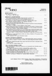
Plant Science 1993: Vol 93 Table of Contents
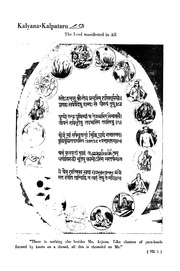
Kalyana Kalpataru Gita-tattva No Ii
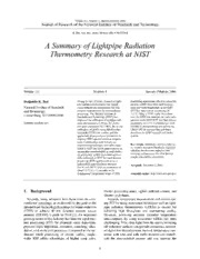
A Summary of Lightpipe Radiation Thermometry Research at NIST
NASA Technical Reports Server (NTRS) 20080015510: Utilizing Calibrated GPS Reflected Signals to Estimate Soil Reflectivity and Dielectric Constant: Results from SMEX02
NASA Technical Reports Server (NTRS) 20080014294: Arbitrary Steady-State Solutions with the K-epsilon Model
NASA Technical Reports Server (NTRS) 20080006487: An Intercomparison of Microphysical Retrieval Algorithms for Upper Tropospheric Ice Clouds
Tafseer-e-Siddiqi (Volume 27)

Tales of Men and Ghosts by Edith Wharton
The Ethic of the Assassin by Hayden Howard
C2-SİMETRİK BAZI KİRAL TAÇ ETERLERİN SENTEZİ VE UYGULAMALARI Devran AK
Our Soldier Boy by George Manville Fenn
Dickens in Camp by Bret Harte
Journal of Entomology and Zoology September 1917 by Various Contributors
