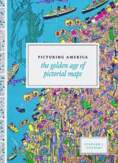
Picturing America: The Golden Age of Pictorial Maps PDF
Preview Picturing America: The Golden Age of Pictorial Maps
picturing America picturing America the golden age of pictorial maps Stephen J. Hornsby the university of chicago press chicago & london The University of Chicago Press, Chicago 60637 The University of Chicago Press, Ltd., London © 2017 by Stephen J. Hornsby and The Library of Congress All rights reserved. Published 2017. Printed in China 26 25 24 23 22 21 20 19 18 17 1 2 3 4 5 isbn- 13: 978- 0- 226- 38604- 1 (cloth) isbn- 13: 978- 0- 226- 38618- 8 (e- book) doi: 10.7208/chicago/9780226386188.001.0001 Library of Congress Cataloging- in- Publication Data Names: Hornsby, Stephen J. (Stephen John), 1956– author. | Ehrenberg, Ralph E., 1937– writer of foreword. | Library of Congress. Geography and Map Division, contributor, publisher. Title: Picturing America : the golden age of pictorial maps / Stephen J. Hornsby. Description: Chicago ; London : The University of Chicago Press, in association with the Library of Congress, 2017. | Includes bibliographical references and index. | Shows maps of the United States of America and other geographical areas of the world. | “Pic- torial maps are artistic renderings rather than scientific representations of places that combine cartographic elements with texts and images and feature bold and arresting graphic design, bright and cheerful colors, and lively detail. In the United States, the 1920s through about 1970 represented a golden age for the form, which this book looks at and considers as a genre”— Provided by publisher. Identifiers: lccn 2016012939 | isbn 9780226386041 (cloth : alk. paper) | isbn 9780226386188 (e- book) Subjects: lcsh: United States— Maps. | Pictorial maps. | Pictorial maps— History— 20th century. | Cartography— United States— History— 20th century. | lcgft: Atlases. | Pictorial maps. Classification: lcc g1201.a5 h67 2017 | ddc 912.73— dc23 lc record available at https://lccn. loc.gov/2016012939 This paper meets the requirements of ansi/niso z39.48– 1992 (Permanence of Paper). for Anne contents Foreword by Ralph E. Ehrenberg ix Pictorial Maps: An American Genre 1 Maps to Amuse 57 Maps to Instruct 77 Maps of Place and Region 117 Maps for Industry 185 Maps for War 225 Maps for Postwar America 243 Acknowledgments 267 Notes 269 Index 281 foreword Maps and atlases have been an important part of the collections of the Library of Congress since its establishment in 1800 when a congressional committee purchased three maps and an atlas from a London dealer. From this modest beginning, the Library’s cartographic holdings have grown during the past two centuries to more than five million maps, atlases, globes, terrain models, and geospatial digital datasets. The Library’s Geography and Map Division has custody of the bulk of these cartographic materials. Established in 1897 as the Hall of Maps to serve Con- gress and US government agencies, the Geography and Map Division functions as the National Map Library. Its primary responsibilities are developing and preserving the Library’s cartographic collections and making them available to Congress, government officials, scholars, and the general public through a research reference center and website. An average of forty thousand analogue and digital cartographic materials are acquired yearly through government de- posits, transfers of superseded maps from US government libraries, copyright deposits, domestic and international exchanges, purchases, and donations. These range from rare maps and atlases to state- of- the- art electronic geospatial datasets in 150 languages. Some four hundred thousand cartographic materials have been cataloged, and their bibliographic records are available online. As a major service to the map library community, the division also establishes, ix
Description: