NASA Technical Reports Server (NTRS) 20160000990: Real-time Land Information System over the Continental U.S. for Situational Awareness and Local Numerical Weather Prediction Applications PDF
Preview NASA Technical Reports Server (NTRS) 20160000990: Real-time Land Information System over the Continental U.S. for Situational Awareness and Local Numerical Weather Prediction Applications
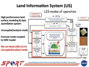
Real-’me Land Informa’on System over the Con’nental U.S. for Situa’onal Awareness and Local Numerical Weather Predic’on Applica’ons Jonathan L. Case1*, Kristopher D. White2, Brian Guyer3, Jim Meyer4, Jayanthi Srikishen5, Clay Blankenship5 and Bradley T. Zavodsky6, NASA/Short-term Predic1on Research and Transi1on (SPoRT) Center 1*ENSCO, Inc.; 2NOAA/Na1onal Weather Service (NWS) Huntsville, AL; 3NOAA/NWS Albuquerque, NM; 4NOAA/NWS Tucson, AZ; 5Universi1es Space Research Associa1on; 6NASA/Marshall Space Flight Center PresentaIon 3.3; 12 Jan 2016; 30th Conf. Hydrology; 96th AMS annual meeIng; New Orleans, LA Session on Hydrometeorological applicaIons, products and services in service to society transi’oning research data to the opera’onal weather community Mo’va’on and Presenta’on Outline • Mo’va’on: high-resolu’on, real-’me soil moisture for – SituaIonal awareness (assessing drought/flood potenIal) – Local modeling applicaIons (to improve sfc-PBL exchanges) • Land Informa’on System (LIS) – 30+ year soil moisture climatology & percenIle product – LIS background and NASA/SPoRT-LIS real-Ime Noah LSM – EvaluaIon at NOAA/NWS forecast offices • Examples from 2015 summer evalua’on • Future work: – Real-Ime soil moisture data assimilaIon with SMAP / SMOS – NaIonal Water Center collaboraIons transi’oning research data to the opera’onal weather community NASA/SPoRT Center Short-term Predic’on Research and Transi’on (SPoRT) o TransiIons unique NASA and NOAA observaIons and research capabiliIes to the operaIonal weather community to improve short-term weather forecasts on regional and local scales o Proven paradigm for transi1on of research and experimental data to opera1ons o Close collaboraIon with numerous NWS WFOs across the U.S. o Began in 2002; co-funded by NOAA since 2009 through “proving ground” acIviIes transi’oning research data to the opera’onal weather community Land Informa’on System (LIS) High-performance land surface modeling & data assimila’on system Uncoupled/analysis mode Forecast mode coupled to WRF model We run Noah LSM v3.3 in uncoupled/analysis mode transi’oning research data to the opera’onal weather community LIS-Noah 33-yr Soil Moisture Climatology LIS-Noah run from 1981 to 2013 o CONUS+ domain at 0.03-deg resoluIon (~3 km) o IGBP/MODIS 20-class land use, STATSGO 16-class soil o MODIS/FPAR 30-sec resoluIon monthly GVF climatology (Barlage; from community WRF v3.5.1+) o Atmos. forcing: NARR-based NLDAS-2 hourly data o 35-year spin-up (1979-2013, back to 1979-1980) o Output total column relaIve soil moisture (RSM) once daily Daily climatology for every CONUS county o Basis of RSM percenIle product o Poster 88 in 30th Hydro; Zavodsky et al.; Mon PM session (right) Anima’on of daily total column rela’ve soil moisture distribu’on for Bernalillo county, NM (Albuquerque), with 2014 values in bold dash line. transi’oning research data to the opera’onal weather community SPoRT Real-’me LIS Running Noah LSM Current SPoRT-LIS CONUS domain, Full Con’nental U.S. (CONUS) domain with as displayed in AWIPS II 0.03° (lat/lon) grid resolu’on Restarted from soil moisture climatology Unique characteris’cs of SPoRT-LIS: – Real-Ime S-NPP/VIIRS Green VegetaIon FracIon – Albedo scaled to input vegetaIon – Restart simulaIon strategy to produce real-Ime output (Imeline below) – SPoRT-LIS ingested and displayed in AWIPS II at select NOAA/NWS weather forecast offices – Land surface variables available to iniIalize modeling applicaIons (WRF and STRC/EMS/UEMS) NLDAS-2 forcing GDAS + MRMS forcing GFS forcing Jan 1979 t = current t - 4 days transi’oning research data to the opera’onal weather community SPoRT-LIS Evalua’on: Jun-Aug 2015 SPoRT-LIS for improving situa’onal awareness o NWS forecast offices at Tucson, Albuquerque, and Huntsville o Part of Summer 2015 evaluaIon focused on GPM/IMERG precipitaIon products (see Smith et al. talk 9.6, 30th Hydro, Thursday 2:45pm) o Disseminated select soil moisture grids and change fields o Forecaster surveys and blog posts to highlight product uIlity o ApplicaIons included: § Assessing drought and USDM drought categories § Monitoring soil moisture to help evaluate flooding concerns § Examining soil moisture around wildfires § EvaluaIng risk for blowing dust from convecIve ounlows transi’oning research data to the opera’onal weather community SPoRT-LIS Evalua’on: Flooding and Blowing Dust Outlooks (NWS TWC) Simulated 10-m wind speed over SE AZ 0-10 cm Vol. 0-10 cm Rel. Soil Moisture Soil Moisture Univ. of AZ WRF 20-22z 2 Sep 2015 40-100 cm Rel. 0-200 cm Rel. Soil Moisture Soil Moisture (above) SPoRT-LIS at 09z 2 Sep 2015, as displayed in NWS Tucson, AZ opera’onal AWIPS II Univ. of AZ WRF 02-04z 3 Sep 2015 transi’oning research data to the opera’onal weather community SPoRT-LIS Evalua’on: Soil Moisture Associated with Wildfire (NWS ABQ) Fort Craig, NM wildfire at 830am 27 July 2015. Wildfire grew to ~700 acres over 2 days. (led) 1-yr change in SPoRT-LIS total column rela’ve (right) 0-10 cm SPoRT-LIS volumetric soil moisture soil moisture, valid 12z 27 Jul 2015, as displayed in valid 12z 28 Jul 2015. [Photo credit: Dave DuBois, NM state climatologist] NWS Albuquerque, NM opera’onal AWIPS II. transi’oning research data to the opera’onal weather community SPoRT-LIS Evalua’on: Soil Moisture Change in South Carolina Flooding NASA’s GPM satellite precipita’on es’mate captured 10-20”+ rainfall with some over-es’ma’on (right) GPM/IMERG AHPS Rainfall 29 Sep “before” 6 Oct “ader” drought map drought map transi’oning research data to the opera’onal weather community
