Geology of National Parks of Central/Southern Kenya and Northern Tanzania PDF
Preview Geology of National Parks of Central/Southern Kenya and Northern Tanzania
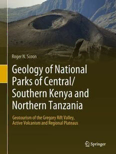
Roger N. Scoon Geology of National Parks of Central/ Southern Kenya and Northern Tanzania Geotourism of the Gregory Rift Valley, Active Volcanism and Regional Plateaus Geology of National Parks of Central/Southern Kenya and Northern Tanzania Roger N. Scoon Geology of National Parks of Central/Southern Kenya and Northern Tanzania Geotourism of the Gregory Rift Valley, Active Volcanism and Regional Plateaus 123 RogerN.Scoon Department ofGeology RhodesUniversity Grahamstown SouthAfrica Everyefforthasbeenmadetocontactthecopyrightholdersofthefiguresandtableswhichhavebeenreproducedfrom other sources. Anyone who has not been properly credited is requested to contact the publishers, so that due acknowledgmentmaybemadeinsubsequenteditions. ISBN978-3-319-73784-3 ISBN978-3-319-73785-0 (eBook) https://doi.org/10.1007/978-3-319-73785-0 LibraryofCongressControlNumber:2017963521 ©SpringerInternationalPublishingAG,partofSpringerNature2018 Thisworkissubjecttocopyright.AllrightsarereservedbythePublisher,whetherthewholeorpartofthematerialis concerned,specificallytherightsoftranslation,reprinting,reuseofillustrations,recitation,broadcasting,reproduction on microfilms or in any other physical way, and transmission or information storage and retrieval, electronic adaptation,computersoftware,orbysimilarordissimilarmethodologynowknownorhereafterdeveloped. Theuseofgeneraldescriptivenames,registerednames,trademarks,servicemarks,etc.inthispublicationdoesnot imply,evenintheabsenceofaspecificstatement,thatsuchnamesareexemptfromtherelevantprotectivelawsand regulationsandthereforefreeforgeneraluse. Thepublisher,theauthorsandtheeditorsaresafetoassumethattheadviceandinformationinthisbookarebelieved tobetrueandaccurateatthedateofpublication.Neitherthepublishernortheauthorsortheeditorsgiveawarranty, expressorimplied,withrespecttothematerialcontainedhereinorforanyerrorsoromissionsthatmayhavebeen made. The publisher remains neutral with regard to jurisdictional claims in published maps and institutional affiliations. Coverphotographs:Frontcover(andp.ii):TheAshConeinthegiantcalderaofMountMeru,ArushaNationalParkin northernTanzania,whichlasteruptedin1910(photographbytheauthor).Backcover:Theauthorandhiswife. Printedonacid-freepaper ThisSpringerimprintispublishedbytheregisteredcompanySpringerInternationalPublishingAGpart ofSpringerNature Theregisteredcompanyaddressis:Gewerbestrasse11,6330Cham,Switzerland TheWesternEscarpmentoftheGregoryRiftValleynearLakeNatron,northernTanzania,asviewedlookingnorthwardsfromthe slopesofOldoinyoLengaiismadeupofmultiple,near-horizontallayersoflavaandtephra.Thebraideddrainagesysteminthe valleyisindicativeofarecentlyformedlandsurface(byR.N.Scoon) Asatelliteimageofcentral/southernKenyaandnorthernTanzaniarevealsthegreatdiversityofecosystemsintheregion.Thetwo principal geological phenomena are the occurrence of ancient regional plateaus, e.g. the Serengeti and Tsavo Plains and the GregoryRift.ThelatterconstitutesanarrowlinearriftvalleyboundedbyescarpmentswithinKenya,e.g.theMauEscarpment,but divergesintoseveralbranchesinnorthernTanzania.Acharacteristicfeatureoftheriftvalleyisthechainofribbon-shaped,alkaline lakes, e.g. Lakes Natron, Manyara and Eyasi. Lake Baringo with its rounded profile and freshwater is unusual. Many of the rift platformsjuxtaposedtotheriftvalleyarecappedbygreatthicknessesofplateau-stylevolcanicoutpourings,e.g.thoseforming theAberdareRange.Riftplatformsalsoincludegiantvolcanicedificeswithsuccessive(annular)botanicalzonesthatincludedense montaneforestsonthelowermostslopes,e.g.MountsElgon,KenyaandKilimanjaro.Theexplosivestyleofvolcanismthattypifies continental rifting has resulted in some cones being capped by giant calderas, e.g. Ngorongoro and Menengai. Active volcanic conesoccurbothintheriftvalley,e.g.OldoinyoLengai,andonriftplatforms,e.g.MountMeru.Source:Cloud-freecompositeimage basedonTerra-MODISsatelliteimagesofNASAcourtesyofPhilipEales(PlanetaryVisions),withdigitalterraneshadingcreated usingArcGIS®softwarebyEsribyOliverBurdekin(birdGIS). National Parks, Reserves and Conservation Areas Central and Southern Kenya: Aberdare;Amboseli;ChyuluHills;Hell’sGate;LakeBaringo;LakeBogoria;LakeNaivasha; Lake Nakuru; Mount Longonot; Mount Elgon*; Mount Kenya; Tsavo West Northern Tanzania: Arusha (Mount Meru); Kilimanjaro; Lake Eyasi; Lake Manyara; Lake Natron and the Oldoinyo Lengai Volcano; Ngorongoro; Oldupai Gorge and Laetoli; Serengeti *Includes a park in Uganda. vii Preface The national parks, reserves and conservation areas of central/southern Kenya and northern Tanzania host some of the largest and most diverse concentrations of wildlife remaining on Earth. Theyalso have remarkablepotential for geotourismandcreationofgeoparks.1Many of the most spectacular landforms are associated with the dominant geological feature of the region,theEastAfricanRiftSystem(EARS).KenyaandnorthernTanzaniaaretransectedby theGregoryRift,theeasternbranchofasystemthatextendsinitsentiretyforover6,000km. Themostprominentexpressionoftheriftisanarrow,down-faultedlinearvalleyborderedby spectacular escarpments (Frontispiece 1). The EARS also constitutes one of the largest vol- canic provinces on Earth. Sections of the rift valley resemble lunar landscapes in areas of particularly intensive volcanism. An unusual feature of the Gregory Rift is the occurrence of giantvolcanicedificesontheriftplatforms(Cover).Asatelliteimage(Frontispiece2)reveals many of these features including the chain of ribbon-shaped lakes which characterise the rift valley. TheriftplatformswhichconstraintheGregoryRiftValleyhavebeenupliftedtoelevations sufficiently high as to report a temperate climate with montane forests, despite the equatorial setting. Montaneforestsalsooccuronthehigher volcanic cones,severalofwhichareamong thelargestfree-standingmountainsonEarth.Thetwohighestpeaksintheregion,Kilimanjaro (a dormant volcano) and Mount Kenya (an extinct volcano), are capped by the relicts of fast-melting icefields and glaciers. The region includes two ‘Natural Wonders of the World’, the Serengeti Plains, famed for the biannual migration of almost two million grazers, and the NgorongoroCaldera,aself-containedreservecreatedbyacatastrophicvolcaniceruption.The palaeoanthropological sites of Oldupai Gorge and Laetoli, where some of the most important discoveries of hominin fossils and footprints have been made, are located between Ngoron- goro and the Serengeti. The region is underlain in some areas by crystalline metamorphic rocks of the basement complexes.TheSerengetiPlains,forexample,revealsexposuresoftheLakeVictoriaTerrane whichcontainssomeoftheoldestrocksonEarth(oldestagesreportedinthisareaare2.810Ga). TheTsavoPlainsincludeexposuresoftheMozambiqueBelt,anextensivegroupofrockswith an average age of 800–500 Ma. A characteristic feature of the East African landscape is the occurrence of regional plateaus; they formed due to repeated episodes of uplift and erosion associated with the breakup of the ancient supercontinent of Gondwana (commencing at approximately 180 Ma). It is these cycles of uplift and erosion which enabled the basement complexestobeexposedonsurface.TheEARSisarelativelyrecenteventwhichcommencedat approximately30Ma.RiftingisstretchingandthinningtheAfricanPlate.Themainperiodsof faulting in the Gregory Rift are even younger (3.7–1.4 Ma). Continental rifting is invariably associated with the alkaline style of magmas, and volcanism of the EARS is further charac- terisedbyhighlyexplosivePlinian-styleeruptions.Numerouscatastrophiceventsarepreserved 1Geopark: A Geopark is a unified area that advances the protection and use of geological heritage in a sustainable way, and promotes the economic well-being of the people who live there. There are Global GeoparksandNationalGeoparks(Wikipedia). ix x Preface inthegeologicalrecord;theseincludegiantcalderasandsectorcollapseswhichhavegenerated among the largest debris avalanches recorded. The high sodium content of these magmas, together with restricted catchments and high rates of evaporation, resulted in the extreme alkalinityofmanylakesintheGregoryRiftValley. The interrelationship between wildlife and geology is emphasised. The relatively youthful volcanic uplands, for example, provide a range of ecosystems and supply groundwater to the much older regional plateaus that would otherwise be far too arid to support large concen- trationsofwildlife.Theintensityofvolcanismisnotcompatiblewiththegeneralisedviewof endlessplainsandvastherdsthatmigrateoverancient,unchangedlandscapes.Thegeological record provides evidence of persistent changes. Recent eruptions of the active Oldoinyo Lengai Volcano have resulted in the spread of ashes onto the Serengeti Plains which support the nutrient-rich short grasses on which the migrating grazers congregate annually. The epi- sodic nature of the rifting and volcanism produced smaller and smaller geological terranes. This may have resulted in the remarkable diversity of species for which East Africa is so renowned. Anomalously rapid speciation may have been triggered as a reaction to these new terranes as well as to the unusually high concentrations of radioactive minerals. Initiation of new species by Darwinian evolution during the Pliocene and Pleistocene epochs (5.3 Ma– 11,500 BP), including hominins, occurred in remarkably short time intervals during extreme climatic cycles (e.g. the Ice Ages) and intense volcanism. The Holocene epoch represents a relatively quiescent period in which Homo sapiens thrived during a time of modest climatic cycles and less intense volcanism. Grahamstown, South Africa Roger N. Scoon
