Preview Forests in the Czech Republic
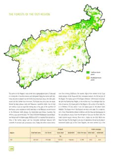
THE FORESTS OF THE ÚSTÍ REGION Coniferous forests prevail Broadleaved forests prevail The surface of the Region is very varied from ageographical point of view and noes form striking landmarks.The eastern edge of the remains of the huge its countryside is therefore diverse and variegated.Along the border with Ger- strato-volcano of the Doupovské hory mountains extends into the territory of many,the area is closed in by the Krušné hory mountains range,the Labe sand- the Region.The highest point of the Region (Klínovec 1244 m) lies on the bor- stones and the Lužické hory mountains.The Krušné hory are avery old range, der with the Karlovy Vary Region,in the Krušné hory.If we disregard the bot- formed by deep igneous rocks and Palaeozoic crystalline shales.Due to high toms of quarries,the lowest point of the Region is the surface of the Labe Riv- ore content,it was an important mining area in the past.In the southeast of er at Hřensko (115 m), which is also the lowest point in the whole Czech the Region,plains spread out which date back to the Mesozoic era and known Republic.The largest river in the Region’sterritory is the Labe.To acertain ex- as the Bohemian chalk plateau. Our historically most famous mountain, Říp tent,it has influenced the natural conditions and the historical development of (459 m),rises out of the plain.The České Středohoří (Bohemian Central Moun- the area along its course.From the left bank of the river,the River Ohře,the tain Range) with its highest peak,Milešovka (837 m) resulted from volcanic ac- Labe’s second largest tributary,flows into it.Higher up,the River Bílina also tivity in the Tertiary period and has inimitable landscape features, with feeds the Labe.The Ústí Region is an area of superlatives.As well as the above- awealth of contrasts and picturesque coves.Today,the extinct conical volca- mentioned lowest spot of the Czech Republic, the most northern tip of the of which Forest coverage Region Total land area non-forest forest land timberland trees free area forest land timberland ha % Ústí 533 451 373 500 159 951 156 642 3 309 30,0 29,4 228 THE FORESTS OF THE ÚSTÍ REGION country,the district with the lowest rainfall of former Czechoslovakia,the high- újezds.In the 13th century,settlement reached the mountain plateaus of the est concentration of neo-volcanic rock and also the windiest place in the re- Krušné hory and the Labské pískovce sandstone area.At this time,new settlers public (Milešovka). from German lands contributed to colonisation. In the harsh climate of the Forest cover is 30 %,lower than the national average,making it one of the mountains,farming could not be the only source of livelihood and so additional four least forested Regions in the Czech Republic.The relatively high forest employment began develop.Prospecting and mining was asignificant choice, cover of the Krušné hory contrasts with the sparse forest cover of the Labe and causing further exploitation of the forest.Smelting works,glassworks,hammer Ohře river valleys.The District of Děčín has maintained the highest forest cov- mills and mines consumed massive amounts of wood.Aconsiderable depletion er.The least forested are the counties of Louny and Litoměřice.Forest cover has of the forest caused adrop in the retention ability of some areas and frequent changed over the course of history and reflects the development of human so- flooding hit alongside rivers and in lowland areas.An increased pressure on ciety in this area. wood as a raw material came after the Thirty Years’ War when communities Already in the Early Stone Age, the low-lying areas of the territory of to- and farms began to be renovated.Technical advances in subsequent centuries day’s Region were a sought-after temporary stopping point for groups of meant more and more devastation of the forests and in the end not even the hunter-gatherers due to the favourable climate,sufficient food and material for forests on the high ground of the Krušné hory were spared. Quarrying the making tools.During the mild climate of the Atlantic era (6–5 thousand years brown coal deposits of the basin below the Krušné hory had a disastrous ef- BC),the forests began to expand,deciduous forests growing at lower altitudes, fect on the forests.The forest was soon driven out of the basins to otherwise mixed forests in higher elevations.The arrival of the first farmers from the east useless areas.Numerous and frequent transfer of forest stands occurred dur- and the so-called Neolithic Revolution related to this meant the first significant ing exploitation of non-ore materials.At first, the areas were left to natural blows to the forests.Arable land was gained by intensive felling and burning succession,later they were systematically reforested as part of recultivation of down the forests,at first only in the near vicinity of settlements,later over larg- the forest, mostly by substitute, non-local tree species. The original forest er areas.The forests were used to graze numerous herds of cattle,so prevent- stands with afairly high representation of deciduous species were gradually re- ing natural regeneration of the forest,heliophilous species increased in num- placed by conifer stands,meaning revolutionary interference in the tree com- bers more and more and so acultivated forest-steppe began to spread.As one position.The end of the first half of the 20thcentury brought heavy pollution to culture replaced another,the method and intensity of forest use changed.The the area,due to the fast growth of industry and aconcentration of power sta- compact and massive frontier primeval forests resisted the pressures of civili- tions in the basin areas of the Region: the districts of Chomutov, Most and sation for avery long time.It was the basin areas which were settled first and Teplice.This resulted in the death of most of the spruce stands in the mountain the local forests underwent fundamental and permanent changes very early on. Each technical advance, new metallurgi- cal methods, for instance, brought in- creased forest exploitation and with it, further expansion of the forestless culti- vated steppe.In further periods,the size of forest cover changed according to how each particular culture used the territory for farming. Particularly during the time of the German colonisation,the forest re- turned to its original position.After the arrival of the Slavs,the traditional forest- steppe method was used again and only in the 10th and 11th centuries did settle- ment begin to shift into upland areas of 350–500 m.Further intensification of the settling process came in the 12thcentury, when the colonisation aspirations of the Crown and the Church peaked by creat- ing so-called újezds (tr. – settlements with surrounding fields and meadows). The whole of the České Středohoří and Doupov Mountains were settled using the Do you think you can guess what forest stands can be found in the Nature Park Buky nad Kameničkou? Then, call number... 229 THE FORESTS OF THE ÚSTÍ REGION 230 THE FORESTS OF THE ÚSTÍ REGION View of the Ohře River with the ruins of Himlštejn; at the back, the mountain ridge of Krušné hory and the peak Klínovec plateau area of the Krušné hory and partially in the Doupov Mountains as well. From the mid 1990s, the pollution levels began to fall and today, high levels are recorded only in the close vicinity of large urban and in- dustrial agglomerations.After widespread felling of the pollution-hit dead stands,the climax spruce forests were replaced by non-native species or spruce of other origin.The non-endemic Colorado Blue spruce used was the only tree species to resist the pressure of emissions and created a more friendly microclimate for later replacement by plantations of the intended species.This was confirmed by the emission incident of winter 1995/96 when many other species died over awide area as aresult of the sudden increase of emissions.Most of the forests in the Region are clas- sified as special purpose forests.The reason is mainly to protect sources of healing and mineral water (Teplice, Bílina, Břvany, Zaječice, Spa Mšené),inclusion of forests in NP České Švýcarsko,Labské pískovce PLA, Lužické hory PLA and České středohoří PLA,tree gene pool and first zones of hygiene protection of water sources.Asmall section of special purpose forests are part of small-scale protected areas (NNM,Nature Parks) and game preserves (Červený Hrádek,Fláje,Brandov).Protection forests are to be found mainly on unfavourable sites – on peatland (Krušné hory),rock formations (Labské pískovce) and alittle more in recultivated areas with soil-protection roles (regions of Most,Chomutov,Bílina).Aspecial group of forests are those affected by pollution. NFA Krušné hory Alarge and the most defined forest area in the Region is the eastern part of NFA Krušné hory which encompasses the forests in the northwest of the Region.The Krušné hory are the oldest mountain range after the Krkonoše Mountains in the Czech Republic and have features of an old,Palaeolithic escarpment smoothed down by geological processes.The area is special for its cold climate mountain plateaus with an altitude range of 700–1000m and the ridge drops quite steeply into the rift below almost without any foothills.The height difference is as much as 700 min places.The highest point is the massif of Klínovec (1 244 m).Mineral-poor rocks are in the majority,producing acidic cambisols (brown forest soils).In the mountains, the most widespread soils are mountain brown soils, often with podsol and medium rich in minerals.In the foothills and lower elevations,soils are low in nutrients,also with podsols.On mountain plateaus,there are peat- land gleys merging into peat.The striking increase in height is reflected in the vegetation zones.The largest area is enjoyed by the 5thFVZ – fir-beech, which comprises about 31 % of the area.The 6thFVZ – spruce-beech and the 7th FVZ – beech-spruce have equal presence (around 27 %). The 8thFVZ – spruce forms approx.9 % and the highest 9thFVZ – dwarf pine, 1%.At the foot of the massif,some lower vegetation zones are found e.g. the 3rdFVZ – oak-beech (approx.5 %).Wetland peat spruce forests grow on mountain plateaus.From the foot of the mountains to the peak areas, all forest vegetation zones are represented at least to some extent. 231 THE FORESTS OF THE ÚSTÍ REGION Pine in the National Park České Švýcarsko Scots Pine Scots Pine (Pinus sylvestris L.)from the family Pinaceae,together with birch isolated sites in uplands and lower mountains,mostly on extreme saxicolous began to spread gradually over our territory as aresult of warm interstadial in sites or on sands and shallow soils of lower altitudes.At present,its original the last glacial epoch during the Allerød period (10 000–8 800 BC).Fast ex- areas of occurrence are scattered on extreme relic habitats called relic pine pansion of these more resistant tree species was facilitated by the presence of forests.The lowest altitudes of their occurrence are on sandy drifts and ter- their refugia in Central Europe.In the Pre-boreal period (8 300–6 800 BC),the races with poor-quality airborne sands around the Labe river,on the serpenti- landscape had the character of open taiga similar to the present boreal forests nite of the Slavkovský les forest and Czech-Moravian Highlands,on the boul- with pine,birch,juniper,willows,alder and heathers.Later on,in the Boreal pe- der slopes and screes in Šumava (the upper limit of its occurrence in our riod (approximately 6800–5500 BC) and due to afurther rise in temperature, country is the scree-forest by Plešné Lake at 1070 mabove sea level),as well new species expanded into the woodlands:oak,elm,linden,maple and hazel, as on the sands and peat land around Třeboň,on the sandstone rocks and the which was characteristic for the period.Mixed oak forests reached their max- rock pillar landscapes in Northern and North-Eastern Bohemia (around Doksy) imum density in the Atlantic period (5 500–2 500 BC).Autochthonous vegeta- or on the rocky steep slopes cut into the valleys of the Jihlava,Oslava,Rokyt- tion of pine and birch began to be reduced and its occurrence was limited to ná and Dyje rivers.Relic pine forests can also be found on the edges of the 232 THE FORESTS OF THE ÚSTÍ REGION The territory was always considerably thick in forest,only with the occasional the Mesolithic era. Constant settlement and more systematic interest of the settlement enclave.The thick and,from the Czech side,hard to penetrate belt Krušné hory began towards the end of the Bronze Age when people of the of the Krušné hory forests did not tempt the first inhabitants of our land to set- Knovíz culture settled in the area (around 1000 BC).Gradually other cultures tle permanently and so the first people came to the foot of the Krušné hory in moved through the area – Únětice,Lusatian and Bylany.Only the coming of Drahany Uplands,on screes in Hrubý Jeseník and on the limestone rocks of duction of railway sleepers and telegraph poles.It is also one of the most suit- Southern Moravia.At present,Scots pine is cultivated throughout the Czech able woods for boat building,kitchen furniture,windows and doors.Its ap- Republic (with the exception of higher altitudes) on an area which is approxi- pearance and good workability make it suitable for wood carving.Pine is the mately three times larger than its natural range in our country. only wood which can be used for the production of coffins for Orthodox Jews. Scots pine is an evergreen species which reaches the height of 20–45 mand Owing to its high content of resin and volatile oils,the wood is used in chem- astem diameter of up to 1 m.It can live 300–350 years and in favourable con- ical industry as well.Through distilling,some pine resin can be altered into tur- ditions even longer.On extreme sites it is usually shorter,in some places reach- pentine:alight-yellow volatile oil which used to be industrially used for thin- ing only shrub heights.In young specimens the crown is regularly conical and ning oil-based paints or for producing varnishes.The distillation by-product is whorl-branched. Older specimens have wide crowns spread into irregularly also rosin.In the past,tissue locally called “sosnovka”(pine tissue) or “forest rounded,even umbrella-like shape.The bulk of the root system usually consists wool”was made by macerating fresh needles and was used for production of of asubstantial tap root with numerous secondary roots penetrating the soil carpets,blankets or as padding. aslant.The tree is therefore resistant to windfalls.Its stem is often low grade Pine is valued both by traditional and clinical medicine for its effects in curing and particularly on extreme sites it is often crooked.The bark is dark grey- asthma and other bronchial ailments.Turpentine is used for curing certain brown on the lower trunk,and thin,flaky and characteristically orange on the eczema as well.For medicinal purposes mainly buds,young sprouts,needles upper trunk.The pointed needles are a glaucous blue-green to dark green, and resin are used.The buds contain high concentrations of volatile oil called 4–8cm long,tough,produced in fascicles of two on small brachyblasts.Their pineol,which has strong antiseptic properties and also releases phlegm.It is persistence is between 2–3 years.Its flowers are monoecious,male catkins are also used as asedative and in aromatherapy.It also has strong antibacterial yellow,female flowers are red and on stems,usually borne in pairs at the tips properties.The air in pine forests is practically sterile,one cubic meter contains of buds.Cones are highly variable,usually grey-green with matt upper scales, 200–300 bacteria while the same amount of city air contains over 30 000 bac- conical,3–6 cm in length and mature after three years.The seeds are ovoid- teria.In extreme habitats pine is used in erosion control planting and in land conic,shiny and winged.They retain germination capacity for 4–5 years. reclamation.A number of its ornamental cultivars are also utilized in land- Pine is intolerant of shade and grows on awide variety of soil types.It grows scape gardening.Last but not least,pine is one of the most popular Christmas on extremely dry soils,as well as waterlogged and peat land sites.It grows trees. best on freely drained acidic to slightly alcalic loose soils.Its roots can pene- Several other pine species can be found in the area of the Czech Republic.In trate deep into the soil even through cracks in rocks.From aforest manage- the Jizerské,Krkonoše and Šumava Mountains grows the native Dwarf Pine ment perspective it is asignificant pioneer tree species which has been suc- (Pinus mugo TURRA),which has a shrubbery appearance.The Třeboň Basin, cessfully planted on peat lands,sand and rocky bases.It is not demanding in Krušné hory,Žďárské vrchy hills,Šumava,Hrubý Jeseník and Slavkovský les for- terms of climatic conditions because it tolerates both freezing and extremely est are anatural home to Bog Pine (Pinus rotundata LINK).In the past,Euro- high temperatures well.Scots pine has adapted to the selective pressure of lo- pean Black Pine (Pinus nigra ARNOLD),which originally comes from Southern cal conditions and has formed anumber of local ecotypes.Thanks to focused Europe,used to be planted in vast numbers,mainly in extreme sites.Other pine forest management,Scots pine has spread outside its natural range to vast species include for instance Jack Pine (Pinus banksiana LAMB),which is native production forests. to Canada and the USA.Among pines with three needles on the brachyblast Pine has soft and fragile resinous wood with orange-brown heartwood and we can locally find Ponderosa Pine (Pinus ponderosa P.et LAWSON) and Pitch wider yellow sapwood.Its growth rings are prominent and therefore there are Pine (Pinus rigida MILL).Both are native to North America and were used as major differences in density and hardness of spring and summer growth rings. soil-improving species. Pines with five needles in the fascicle occur in our Its natural glossiness is caused by ahigh content of resin.It has anatural dry country as well,among them Swiss Stone Pine (Pinus cembra L.)and Eastern density of approximately 490 kg/m3. Its wood is resilient, light but highly White Pine (Pinus strobus L.).The former is native to the Alps and Carpathians durable even in humid environment.It is easily cleavable,has the largest knots and in our country it is planted mainly in parks.In the wild it occurs,for ex- of all conifers and is prone to turning blue. It is versatile in use, mainly in ample in Šumava.However,it was introduced by people.Eastern White Pine is places where resistance to weather and decay is required.It is used in build- characterised by its fine thin needles and is considered an invasive and unde- ing constructions and in joinery,as structural timber in mines and for the pro- sirable species. 233 THE FORESTS OF THE ÚSTÍ REGION the Celts invigorated the whole of the Krušné hory area. Even though the regulated felling and uprooting of forests for the needs of the foundries.This mountains themselves were not settled until the Middle Ages,the fate of their resulted in the deforestation of aconsiderable part of the mountain massif.Re- forests was fairly unsettled.Until the 12th century,the Krušné hory were still generation of stands was problematic and was mostly left up to nature.Even covered with almost undisturbed forest, the occasional trade route running in subsequent centuries,the mixed forests were badly regenerated and in the through.But already during the 12thand 13thcenturies,unchecked exploitation 19th century they were transformed into monocultures of unsuitable origin. began with mining colonies springing up. The increase of ore mining and Spruce production used over wide areas was introduced in the Krušné hory foundries brought settlers to the mountains and so clearings were made in the sooner than any other mountain areas of the Czech Republic.During such for- forest for new settlements, fields and meadows. Already around 1350, in est management,the original spruce ecotype disappeared.Over the past cen- adraft of the legal code,the “Maiestas Carolina”by Emperor Charles IV,the turies,the Krušné hory have changed massively at the hands of man.The orig- need to preserve the Krušné hory forests as adefence is emphasised.From the inal mixed forests were felled during local ore mining and working and second half of the 15thcentury,the flow of colonisation rose sharply again and replaced with spruce which was the preferred species due to its fast growth. in the mid 16thcentury,aboom in mining began.The most significant were the During the industrial 20thcentury,however,the spruce was unable to stand up silver and tin mines,but also lead,copper and iron was mined.At that time, to air pollution, disastrous infestations of pests, gales and hard frost. The numerous mining towns were established:Měděnec,Cínovec,Kovářská,Hora spruce stands in most of the NFA were hit by air pollution from all sides from Svaté Kateřiny,Vejprty and Krupka.The rich ore seams and mining meant un- the 1950s onwards, which resulted in their death. Industrial growth in the 234 THE FORESTS OF THE ÚSTÍ REGION < Valley of the Kachní potok stream in the NP České Švýcarsko valley floodplain in the Žatecká Basin – 185 m.It is ageologically defined area, formed mostly of Tertiary lake sediments which fill the fault below the Krušné basin area had adetrimental effect on the state of the forests,bringing air and hory.Sandy and clay sediments dominate,with thick deposits of brown coal. soil pollution from mining and industrial activities around Most and Chomutov. The volcanic rock found here in places are basalt,tephra and tuff.In the Žate- By burning coal with high sulphur content for electrical energy production cká Basin,thick Quaternary loess sediments are sued for agriculture.The soil without the necessary desulphurisation resulted in high production of sulphur conditions have long been influenced by man (deforestation, change of the oxides,which produced acid rains,damaging the forest cover. stands structure,agriculture,industry).From apedogenesis point of view,due The upper and middle elevations of the NFA were originally covered with beech to the slight majority of nutrient-rich sites,cambisols are most prevalent,medi- forests with fir,but these were gradually substituted by spruce monocultures of um rich in minerals.On acidic underlays,we find poor brown soils with aten- unsuitable origin.At the end of the 19thcentury,the lower Krušné hory forests dency to podsolisation.The incidence of anthrosols (soils influenced by hu- still had quite alarge proportion of fir,mainly in stands over 100 years old.The mans) is abundant, found in areas which have been transformed during forest cover in the NFA is sharply about average at 70 %.In the present tree intensive open-cast mining for coal,kaolin and other raw materials.There is composition,conifers constitute 74 % and broadleaves 26 %.The dominant isolated incidence of pseudogleys and gleys. species is spruce – 53 %.Consistent beech forest or mixed deciduous forests Fairly rich archaeological finds give reason to believe that the territories of the have survived in some mountain valleys.The least disturbed and most original basins in the Ohře and Bílina catchments were some of the most densely pop- communities are those of high altitude peatlands with Pinus rotundata and oc- ulated areas in the country and have been inhabited constantly since the casional dwarf birch. 5thcentury BC – from the Neolithic era.The sparse network of original hunting The largest of these is NNR Novodomské rašeliniště.It is a large area of peat- settlements was replaced by agricultural communities whose density resem- land of (389 ha) formed of two independent peat bogs.It was designated in bled that of today.This area was gradually settled by several further cultures 1967 and the subject of conservation is ahighland peat watershed with typi- which influenced the appearance of the landscape and the size and condition cal flora and fauna. The peatland complex is one of the best preserved in of the forests variously,depending on how socially advanced they were.Pre- Europe.The Na loučkách Nature Park is not far from the Výsluní railway sta- historic farmers,however,preferred the fertile floury soils,because agriculture tion.It was designated in 1977 over an area of 15.2 ha.This is aKrušné hory was the main source of livelihood in today’sbrown coal basin.After the Celtic peatland with aremarkable habitat of Pinus rotundata.It serves as agene pool period,the Slavs began to intensively settle the area from the 6thcentury. area for seed collection.On aplateau south of Moldava,the NR Grünwaldské The effect of the prehistoric and medieval communities was often very intensive vřesoviště has been under protection since 1977 over an area of 39 ha.The indeed. Our ancient ancestors transformed the area below the Krušné hory reason for conservation is amoor with dwarf pine and typical peat flowers.In (Podkrušnohoří) into a cultivated, modified landscape and gradually they re- 1969,the NNR Jezerka was designated over an area of 136 ha,southwest of moved the forests as the numbers of people in the area increased.Due to ear- Jezeří Chateau.The most natural and preserved mixed stand on the southern ly colonisation and intensive use of the area for agricultural,mining and indus- slopes of the Krušné hory is protected here.On Jezeří Peak,there is the high- trial purposes, the forest communities were pushed out to otherwise useless est altitude oak forest in the Czech Republic.About 1 km to the southeast of sites and the ratio between agricultural and forestland stabilised quite quickly. Volyně,there lies the Lokalita břízy ojcovské uVolyně Nature Park,measuring 1.49 ha and designated in 1986. It is the only example of the Betula oy- coviensis in the territory of the Czech Republic.The Buky na Bouřňáku Nature Park was designated earlier,in 1976.The subject of conservation is a200 year- old beech stand at an elevation of 850 m, markedly deformed by wind into bizarre shapes.Most of the Krušné hory are part of Protected Area of Natural Water Accumulation (PANWA) Krušné hory. NFA Mostecká aŽatecká pánev NFA Mostecká aŽatecká pánev (basin) occupies the eastern part of the basin below the Krušné hory.This part is geologically named the northern Bohemian brown coal basin – formed of four smaller depressions: the Chomutovská, Mostecká,Duchcovská and Teplická.The Žatecká pánev is attached as asub- region of the basin,the transition between the Mostecká Basin and the České středohoří. This forest area is formed foremost by flat and only slightly undulating lowland and upland terrain with an average elevation of 250 m.At the transition to the České středohoří,there are some isolated volcanic hills.The lowest point is the Ponds represent an important element in the water regime of smaller areas (Sedlec) 235 THE FORESTS OF THE ÚSTÍ REGION The forest cover of the Nature Forest Area Lužická pískovcová vrchovina is 74 %. Spruce monocultures and pine prevail (Lužické hory mountains viewed from Rynartice) The development of coal mining began in 1850,firstly by deep shaft mining, sands and gravel-sands.The original forest communities are rare here and both then in surface quarries and mining quickly spread. It gradually swallowed the species composition and genetic value of each tree species is doubtful.In great tracts of agricultural and forestland,starting to upset the ecological bal- many places in the north of the area,recultivation of slag heaps,dumps and ance of the area far and wide.Today,almost the whole of the basin area com- former mining sites is underway using arich mixture of mainly deciduous trees. prises this typical anthropogenic georelief of open-cast mines and slag heaps, In the Most and Žatec basins there is quite a high proportion of commercial in places spontaneously vegetated, elsewhere recultivated using non-native forest. Special purpose forests are designated for protection of healing and tree species. mineral water sources (Teplice, Zaječice, Bílina), hygiene protection zone I, The original forests of the area were more like small woods or isolated forest recreational areas around spas.Protection forests are stands in unfavourable complexes.Thermophilous oak forests dominated with amixture of hornbeam sites and recultivated areas with a soil protection function.This nature forest and spruce.Along the rivers there grew alluvial forests. area used to be one of the worst hit by air pollution.From the 1990s,pollution The forest cover of the area is the lowest of all regions of the Czech Republic levels have been falling.The number of small-scale protected areas is limited (4.5 %).Smaller forest complexes generally dominate and forest communities and protected areas related to forest stands are not to be found in this NFA. are restricted to the 1stFVZ –oak and 2ndFVZ – beech-oak.Almost even rep- resentation is shown by rich hornbeam-oak forests,acidic (pine-) oak forests, NFA České středohoří rich beech-oak forests,and acidic beech-oak forests.Corni querceta petraeae Aconsiderable part of the eastern half of the Region is occupied by NFA České – pubescentis woods, forest-steppe and alluvial sites are also to be found. středohoří.The České středohoří is aclearly defined young volcanic area which Thermophilous oak forests and on the hills,scree woods grow where the area arose in the late Tertiary era as part of complex geological development.Vol- meets the České středohoří.In the present stands,oak dominates,but it is only canic activity broke through the chalk sediments and over the ages,most of the of quality in alluvial forests and on heavy soils.Pine stands are often found on weathered volcanic material has been taken away.The result of this are the 236 THE FORESTS OF THE ÚSTÍ REGION worn-down cone-shaped hills (mostly volcanic chimneys of the original volca- the first farmers in the Neolithic era (6th–4thmillennium BC) who avoided the noes),so typical of the České středohoří.The diverse interior structure,bedrock high ground.The landscape was,as aresult of its location,influenced by prac- minerals,tectonic movements and erosion by the major rivers have caused the tically all cultures which came through over the ages (Únětice, Lusatian, emergence of avery rich and rugged relief.The unique steep-sloped hills of vol- Knovíz,Celtic,Germanic).Forests in lower elevations were under pressure from canic origin and the deep valleys make the České středohoří one of the most humans from the start.At the end of the Bronze Age (about 500 years BC), distinctive, picturesque and also beautiful mountain ranges in the Czech acooler and wetter period came;settlement partially retreated and the forest Republic. The highest point is Milešovka (836.5 m) and the lowest, at spread back almost to its original dimensions.The Slavs,who began to pene- 123mabove sea level,is the confluence of the Rivers Labe and Ploučnice.The trate the area around the 6thcentury,preferred to settle the areas suitable for main height difference is only 200–600 mand the mean elevation is 363 m. agriculture:the Labe,Ohře and Bílina areas.Most of the forests in these areas The area is the most geologically diverse in the country.The most significant were transformed into fields and orchards,later in the Middle Ages into vine- rocks contributing to the construction are from Tertiary volcanism with varying yards.After the union of Bohemia in the time of the Přemysl family,anetwork appearance, weathering and chemistry. The most widespread are from the of castles existed which were used as bases for colonisation.This was per- basalt series (basalt, nephelinite, phonolite and trachyte) and their tuffs. In formed by monasteries as well (Postoloprty,Doksany,Teplice,Osek).From that places,Tertiary sediments have survived (clays,sands) and revealed Cretaceous time the colonisation process advanced into higher ground.The rich soil facili- sediments (marlstones, sandstones) and partially to basement, with isolate tated an economic boom of new towns and very dense population.By the mid patches of orthogneiss,phyllites and amphibolites.The composition of base- 14th century, the settlement structure that we know today had been estab- ment in the southwest part of the Středohoří between Třebenice and Měrunice lished and the ratio of farmland and forestland stabilised. The forest was is interesting.The bedrock here contains bodies of heavily alkaline rock – i.e. pushed out to locations with shallow soils and steep slopes, but even the peridotites which are the parent rock to pyrope (Czech garnet).Quaternary de- forests here suffered from grazing,so the bare rocky hillocks of today are the posits are represented by loess sediments and light sands. result of washed away soil after years of unregulated pasture and raking up The pedological conditions are also very diverse.Generally,cambisols prevail, hay.Every area with accessible terrain on the edges and sometimes inside for- medium to rich in nutrients (73 %).There are also quite alarge proportion of est complexes was uprooted and used.In the 19thcentury,the forest gradual- undeveloped soils which is aresult of the incidence of rocks resistant to weath- ly began to return to these enclaves by natural regeneration and by artificial ering which create screes,“rock seas”,and boulder-strewn slopes.On basalts, reforestation. The forests of smaller complexes suffered constant felling for alkaline,clayey,soils are usual,sandy-clayey in places,with ahigh content of their precious firewood and so very soon they dropped in quality.The forests broken stone.On loess and marl,the soils are heavier.Particular for this area began to turn into coppice stands – lower quality forests with apreponderance is asmall proportion of waterlogged soils.The significant differences in climate of oak and hornbeam,sprouting into several smaller trunks from acut stump. within the area are due to the various forest vegetation zones ranging from In the surroundings of larger settlements,there was an exceedingly high con- oak to beech. The most prevalent is the sumption of construction timber and wood 3rd FVZ – oak-beech (49 %), followed by for pit props, for glass production and for the 2nd FVZ – beech-oak (30 %). On the saw mills. On the large estates along the highest ground of the area,there is a rare River Labe, quality, strong timber was in- incidence of the 5th FVZ – firbeech. The tensively felled for boatbuilding, building ultra alkaline bedrock causes the absolute towns in Saxony and for the needs of the domination of nitrophilous communities burghers.Not only the oak,but also the fir (66 %).Alkaline oak-beech forests are in and the high quality original spruce began the majority. to disappear from the forest stands.The de- Archaeological finds show that the České ciding factor was the convenient method of středohoří area was frequented by civilisa- wood transport,by rafting on the river.Oak tion far back in history.The reason was the stands which dominated the area were not favourable climatic conditions and the area only utilised as fuel but also for their bark attracting hunters between the České stře- in the tanning industry, for processing dohoří and Krušné hory. Hunter-gatherers leather.Thinner trees were the most suit- had minimal influence on the landscape, able for this:oak was cut fairly young and however.Achange came with the arrival of regeneration went on mainly by stump sprouting.So this type of activity also en- The Nature Monument Kuzov in PLA České stře- couraged the creation of coppice forests.In dohoří is formed of two perpendicular basalt dikes the years 1830 to 1850, when, in the covered with non-native European black pine neighbouring basin areas,brown coal was 237
Description:The list of books you might like

A Thousand Boy Kisses

As Good as Dead

The Mountain Is You

Shatter Me Complete Collection (Shatter Me; Destroy Me; Unravel Me; Fracture Me; Ignite Me)
by BS Geology, Universidad de C6rdoba, Argentina
Phylogenetic, habitat, and behavioural aspects of possum behaviour in European lepidoptera

BWT AQA basic

Tell Me to Stay - Charlotte Byrd
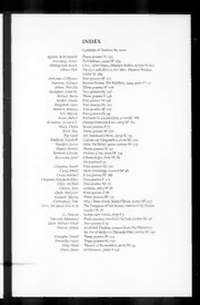
Prairie Schooner 2006: Vol 80 Index

Budget-At-A-Glance, 2006-07

IS/ISO 105-A03: Textiles- Tests for colour fastness Part A02- Grey scales for assessing staining (Superseding IS 769
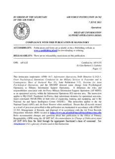
by order of the secretary air force instruction 10-702 of the
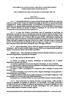
CAPÍTULO I Art. 1º – A Associação Brasileira de Angus, doravante denominada ANGUS, tem sede
BVCM001738 Técnicas analíticas para la detección de gluten en los alimentos

The Dancing Floor
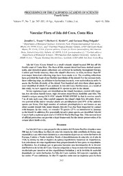
Vascular Flora of Isla del Coco, Costa Rica

C-uppsats_30 maj
Calixarene Complexes with Transition Metal, Lanthanide and Actinide Ions

Amazon Cognito - 개발자 안내서
C uppsats Joni & Anton rev.2 .docx
