Final Plats (AKA “Publication of Results” Jerry Anderson PLS 2836 S PDF
Preview Final Plats (AKA “Publication of Results” Jerry Anderson PLS 2836 S
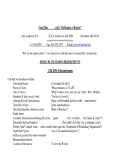
Final Plats (AKA “Publication of Results” Jerry Anderson PLS 2836 S. Ranchview Rd. #206 Brookline MO 65619 ====================== 417-830-0978 Fax: 603-297-1977 Email: [email protected] Why do we prepare plats? (Too many times, only because it’s required by Government.) MISSOURI STANDARDS REQUIREMENTS CSR 2030-16 Requirements Plat shall be furnished to Client Convenient Scale (Convenient for who?) Name of Client (Whose business is THAT?) Date of Survey (What if it takes more than one day? Start? End? Middle) Signature & Seal on each sheet (You have to own it!) Lettering Size & Characteristics (Open, well Rounded, uniform width - Anachronism) Directions of lines (More Anachronisms) Described direction reference system (Basis of Bearings?) North Arrow Complete Dimensions (including directions … again) (Feet or meters No Chains & Links??) Horizontal Surface Distances (They didn’t do it that way in Grandpa’s day!) Written *and* Graphic Scale – unless smaller than legal size (Department of Redundancy Department?) Significant Figures (Lots of misunderstanding here!!) Sufficient geometry to define boundary Monumentation details Location of the survey (Tie it to the World) 20 CSR 2030-2.050 Requirements Title Block Name or Entity of Licensee; Licensee Address & Phone No. Name or ID of Project Address/Location of Project (City County State) Date prepared (Date of Survey or date of seal?) Space for signature, date & seal. Printed Name, Discipline and License Number of person sealing document ADDITIONAL NEAT STUFF REQUIRED BY OTHER STATES Type of survey (What is it?) Name, license number, and street and mailing address of a surveyor Survey date, which is the date of the field survey (Glad THAT’S cleared up!) “True North”; “Grid North as established by the NOS”; “Assumed North based on a bearing for a well defined line, such as the center line of a road or right of way, etc.”; “a Deed Call for a particular line”; or “the bearing of a particular line shown upon a plat.” References in a text report delivered with the map, such as: data sources, measurement methods, history and lineage of data Abbreviation legends, Curved lines with circular curves shall show the radii, arc distances and central angles, or radii, arc distances, chord distances and chord bearings. When intersecting lines are non-radial to a curve, sufficient angular data shall be shown to relate the line to the curve. A comparison between recorded directions and distances with field measured directions and distances when they vary. All monuments, found or placed, must be described on the survey map. Doubt as to the location on the ground of survey lines or property rights. Open and notorious evidence of boundary lines, such as fences, walls, buildings, monuments or otherwise, shall be shown upon the map, together with dimensions sufficient to show their relationship to the boundary line(s). Plat should be readily understood by layman. (Think Realtors and Property Owners) =========================================================================== Who uses our plats? Government (Assessors, Public Utilities) Property Owners (Current, Former, Future) Adjoiners (Can’t survey one side of a line) Other Surveyors (If they can find a copy) What do we usually give them? What do they need? TIPS, TRICKS and SUGGESTIONS Delineate the boundary of the surveyed parcel with a heavier, darker line. Include a well defined symmetrical Title Block (This is a great opportunity to advertise your firm) Include a Clear vicinity map, preferably to a listed scale. Learn and USE the proper one-sixteenth corner designations – otherwise we have to “draw the square” for the POB! Provide a clear Control or Section Breakdown drawing. (Don’t make others resort to sketching it out on a napkin) Include copious (lots of) notes. (I prefer lots of notes on the face of the plat, as opposed to a separate survey report.) Design your own distinctive North Arrow and possibly your own Bar Scale. Provide a descriptive and detailed Symbol Legend (More than IP set; IP found) (What the heck is an IP anyhow) Add Assessors Parcel designation to the surveyed and adjacent property. “Class it up” by adding a picture or some line-art to your drawing. (Someone in your office has some artistic talent) Don’t be ashamed to use and adapt good examples from other firms. Plagiarism can be a sincere form of flattery.
Description: