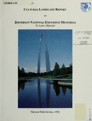
Cultural Landscape Report for Jefferson National Expansion Memorial, St. Louis, Missouri PDF
Preview Cultural Landscape Report for Jefferson National Expansion Memorial, St. Louis, Missouri
I 29.86/4: J 35 Cultural Landscape Report for Jefferson National Expansion Memorial St. Louis, Missouri icnoCUMENTS pT.R! SEP 19 1997 CLEMSON LIBRARY . 1 National Park Service, 1996 CO I Cultural Landscape Report JEFFERSON NATIONAL EXPANSION MEMORIAL ST. LOUIS, MISSOURI PUBLIC OOCIKMENTS SEP 19 1997 CLEMSON LIBRARY by Historical Landscape Architect Regina M. Bellavia Midwest Field Area with the Saarinen/Kiley Design Collaboration History by Landscape Architect Consultant Gregg Bleam Charlottesville, Virginia National Park Service Midwest Field Area Great Plains Systems Support Office Cultural Resources Omaha, Nebraska Digitized by the Internet Archive in 2012 with funding from LYRASIS IVIembers and Sloan Foundation http://archive.org/details/culturallandscap96bell Acknowledgments This CulturalLandscape Report would nothave been possible without thecontinued support and cooperation ofSuperintendent Gary W. Easton and members ofthe staffat Jefferson National Expansion Memorial. In particular. Park Historian Bob Moore shared invaluable information about the history of the park and the important players involved in the development of the Memorial. Archivist Laura Mills provided much assistance and access to archival materials. Civil Engineer Gargar Chan displayed ease and expertise generating the period plans in AutoCAD and was responsible for some of the photography. And finally, Gardener Supervisor Jim Jacobs and the grounds maintenance staffwere instrumental in providing insights regarding maintenance issues and existing conditions. Special thanks to landscape architect Gregg Bleam and his staffin Charlottesville, Virginia for theirresearch and detailed analysis of the relationship and design collaboration of Eero Saarinen and Dan Kiley. Their research on the design analysis and history of the park made up a major portion of "Chapter U: History of Design Development" ofthis Cultural Landscape Report. Thankyou also to Historical Landscape Architect SherdaWilliams ofthe Midwest Field Area, and Historical Landscape Architect David Uschold of the Olmsted Center for Landscape Preservation for their technical support and editorial review comments. And finally, many thanks to former NPS employee Mary Hughes. Without Mary's energy, persistence, and dedication to landscape preservation, this project would neverhave been initiated. Her assistance, support, and guidance throughout the project was greatly appreciated. 11 Contents Acknowledgments i List ofIllustrations v Chapter I: Management Summary 1 ChapterH: History ofDesign Development 1 Chapter HI: Physical History ofthe Landscape 97 Chapter FV: Inventory ofExisting Conditions 117 ChapterV: Statement ofSignificance and Analysis ofIntegrity 149 Chapter VI: Treatment Recommendations 191 Summary 209 Appendices & Appendix A: List ofLandscape Contracts Contractors 21 Appendix B: Sample Inventory & Condition Assessment Forms 219 Appendix C: Evaluation ofLandscape Features 225 Appendix D: Copy ofNational RegisterNomination Form 229 Appendix E: List ofRepositories and People Consulted 241 Select Bibliography 247 1 List of Illustrations Cover Colorphotograph ofArch, 1995 (Courtesy ofArteaga). Back Cover Colorphotograph ofArch grounds, 1995 (Courtesy ofArteaga). Chapter I Figure 1 Context Map: Midwest Region and St. Louis Vicinity. (Bellavia, 1996). Figure 2 Map ofDowntown St. Louis and Jefferson National Expansion Memorial. (JEFF, Site Plan 1995). Chapter II Figure 3 Map ofOld St. Louis and its environs, 1796. (JNEM Archives). 12 Figure 4 St. Louis Riverfront, n.d. (JNEM Archives). 13 Figure 5 National Park Service "Plan 8009," 1937. (JNEM Archives, RU 104, box 31, folder7). 15 Figure 6 Elevated railroad tracks along the levee in St. Louis, n.d. (JNEM Reference Slide Collection). 17 Figure 7 Old Rock House, c. 1943. (JNEM Archives, Visual Image 106-943). 19 Figure 8 Old Cathedral, circa 1939. (JNEM Archives, Visual Image 106-1436). 20 Figure 9 Old Courthouse, 1939. (JNEM Archives, Visual Image 106-175) 21 Figure 10 St. Louis Riverfront afterdemolition ofwarehouses, circa 1942. (JNEM Reference Slide Collection). 23 Figure 1 Map ofPortion ofthe St. Louis Waterfront, 1936. (JNEM Archives). 24 Figure 12 Eero Saarinen's Stage One Submission, Plan View, 1947. (JNEM Archives, Visual Image 104-251). 29 Figure 13 Eero Saarinen's Stage One Submission, Perspective View, 1947. (JNEM Archives, Visual Image 104-252). 30 Figure 14 Eero Saarinen's winning competition entry. Plan View, 1949. (JNEM Archives, Record Unit 104, unnumbered). 35 Figure 15 Eero Saarinen's winning competition entry. Perspective View, 1948. (JNEM Archives, Visual Image 104-321). 36 £age vi ListofIllustrations Figure 16 Eero Saarinen & Associates, Early Railroad Study, 1949. (JNEM Archives). 40 Figure 17 Memorial grounds used formunicipal public parking, 1961. (JNEM Archives, Visual Image 106-4200). 43 Figure 18 Eero Saarinen & Associates, Site Plan Studies, 1957. (JNEM Archives). 45 Figure 19 Eero Saarinen & Associates, Site Plan with 2' contour interval. Drawing 1 of4, October, 1957. (JNEM Archives). 46 & Figure 20 Eero Saarinen Associates, Section Through Old Courthouse to River, Drawing 2 of4, October, 1957. (JNEM Archives). 47 & Figure 21 Eero Saarinen Associates, Plan and Profile ofRelocated Railroad Tracks, Drawing 4 of4, October, 1957. (JNEM Archives). 50 Figure 22 Saarinen and full scale mock-up ofgrand staircase (Courtesy ofYale University Press); Section Detail Through Grand Staircase, November 1960. (JNEM Archives, Record Unit 120, Drawer22, Folder 12). 51 Figure 23 Eero Saarinen & Associates, Site Plan, April 1959. (JNEM Archives). 57 Figure 24 Eero Saarinen & Associates, Site Plan, February 1960. (JNEM Archives). 61 Figure 25 Office ofDan Kiley, Schematic Planting Plan, February 1960. (JNEM Archives). 62 Figure 26 Office ofDan Kiley, Sectional Studies, February 1960. (JNEM Archives). 63 Figure 27 Eero Saarinen & Associates, Site Plan, August 1960. (JNEM Archives). 65 Figure 28 Office ofDan Kiley, Planting Plan Adjacent Railroad Cuts, August 1960. (JNEM Archives). 66 Figure 29 Office ofDan Kiley, Schematic Planting Plan, December 1961 (JNEM . Archives). 71 Figure 30 Office ofDan Kiley, Site Plan, Watercolor, December 1962. (JNEM Reference Photograph Collection). 73 Figure 31 Office ofDan Kiley, Perspective Images, Watercolor, December 1962. (JNEM Archives). 74 Figure 32 Office ofDan Kiley, Perspective Images, Watercolor, December 1962. (JNEM Archives). 75
