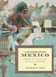
Cartographic Mexico: A History of State Fixations and Fugitive Landscapes PDF
Preview Cartographic Mexico: A History of State Fixations and Fugitive Landscapes
✴ Cartographic Mexico abookintheseries LatinAmericaOtherwise: Languages,Empires,Nations Serieseditors: WalterD.Mignolo,dukeuniversity IreneSilverblatt,dukeuniversity SoniaSald´ıvar-Hull,universityof california,losangeles Mapsmightappeartobeobjectiverecordsofanobjectivegeography,but, asRaymondCraibhasshown,theyareanythingbut.Inhissweeping study of nineteenth- and twentieth-century maps drawn under the auspicesoftheMexicangovernment,Craibpresentsthepoliticalsideof maps—anundersideoftenhiddenbythetechnocraticsurfaceof‘‘map- making.’’Forthesemapsdidn’tsimplyreflectaspatialreality;theycre- atedone.Mapswerepolitics:theymadeMexicoappeartobeaunified, coherententity,andtheydidso,inpart,byplasteringoverconflictsbe- tweengovernmentagenciesandlocalcommunities.Mapsweredoubly functional:theygaveMexicointernaldefinitionandwereakeytoits membershipintheinternationalclubofnations. Withgreatoriginalityandinsight,Craibhasinspecteda‘‘taken- for-granted’’ofmodernlifeandrevealeditsimmersioninrelationsof power.Nonetheless,heiscarefultorecordthesocialcontradictionsand complicationsofmapmaking:whilemapswereatoolofpower,theywere alsochallenged;whilemapsexpressedthewillofgovernmentagencies, theywerealsolighteningrodsof resistance.Mapscouldnevertotally dominatethegeographicalvisionofMexico’ssubjects,and,tobearout Craib’s argument, Mexico is still confounded by conflicts rooted in a questionofmaps,inquestionsofthestate’sversionofterritorial—and political—control.Craib,bypenetratingthesurfaceofsomethingasor- dinaryasmaps,hashelpedusseeLatinAmericaotherwise. ✴ Cartographic Mexico ahistoryofstatefixations andfugitivelandscapes RaymondB.Craib ✴ DukeUniversityPress DurhamandLondon 2004 (cid:1)2004dukeuniversitypress Allrightsreserved PrintedintheUnitedStates ofAmericaonacid-freepaper∞ DesignedbyAmyRuthBuchanan TypesetinJansonbyWilsted& TaylorPublishingServices LibraryofCongressCataloging-in- PublicationDataappearonthelast printedpageofthisbook. Publicationofthisbookwasmadepossible byasubventiongrantedbytheHullMemorial PublicationFundofCornellUniversity. Anearlierversionofchapter1wasoriginally publishedas‘‘ANationalistMetaphysics:State Fixations,NationalMaps,andtheGeo-Historical ImaginationinNineteenth-CenturyMexico,’’ HispanicAmericanHistoricalReview82:1(2002). Anearlierversionofchapter3wasoriginally publishedas‘‘StandardPlotsandRuralResistance,’’ inTheMexicoReader:History,Culture,Politics, editedbyGilbertM.JosephandTimothyJ. Henderson.Durham:DukeUniversity Press,2003. ✴ forcynthia ✴ Contents ListofIllustrations, xi Abbreviations, xiii Acknowledgments, xv Introduction: WritingaSpatialHistoryofModernMexico, 1 1 TheTerrainofTradition, 19 2 FugitiveLandscapes, 55 3 StandardPlots, 91 4 SituatedKnowledges: TheGeographicExplorationCommission(I), 127 5 SpatialProgressions: TheGeographicExplorationCommission(II), 163 6 FluvialConfusions, 193 7 RevolutionarySpaces, 219 Epilogue: ‘‘Thesequestionswillneverend,’’255 Bibliography, 261 Index, 289
Description: