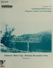
Archeological Monitoring at Dingmans Launch Lower Boat Ramp: Delaware Water Gap National Recreation Area, Pennsylvania PDF
Preview Archeological Monitoring at Dingmans Launch Lower Boat Ramp: Delaware Water Gap National Recreation Area, Pennsylvania
D 1 29.2: 37/8 ClemsonUniversi' September 1993 3 1604 016 837 603 Archeological Monitoring at Dingmans Launch Lower Boat Ramp Delaware Water Gap National Recreation Area Pennsylvania FEDERAL PUBLICATION ARCHEOLOGICAL MONITORING AT DINGMANS LAUNCH LOWER BOAT RAMP DELAWARE WATER GAP NATIONAL RECREATION AREA PIKE COUNTY, PENNSYLVANIA By Michael L. Alterman, Ph.D. PACKAGE NO. 263DA-42 Preparedfor the National Park Service by: The Cultural Resource Group & Louis Berger Associates, Inc. 100 Halsted Street East Orange, New Jersey 07019 Under Contract CX-2000-0-0039 Task Order Nos. 8 and 31 Principal Investigators: & Michael L. Alterman, Louis Berger Associates, Inc. and Paul Y. Inashima, National Park Service Government Technical Representative: Douglas C. Comer, Ph.D., Chief Eastern Applied Archeology Center National Park Service r\\N\EN^ DDeennvveerr SSeerrvviiccee CCeenntteerr--TTEEAA *p»UuBBUU^C °^ ' v -\-T«E-J*A 12200-A Plum Orchard Drive o^poS^ * Silver Spring, Maryland 20904 1993 atwso'J ABSTRACT Archeological monitoring was undertaken at Dingmans Ferry, Delaware Water Gap National Recreation Area, in association with pavement removal and surface grading at the Dingmans Launch Lower Boat Ramp. This development area was within the boundaries of a prehistoric site, 36PH36. Previous investigations at 36PH36 revealed multiple components ranging in age from the Late Archaic through the LateWoodland. Several prehistoric hearth features, including a rock platform 4.5 feet in diameter which dated to the Transitional/Early Woodland, were previously excavated. During the regrading of the Lower Boat Ramp area, eight prehistoric features were noted. These included hearths, shallow or truncated pits, FCR concentrations, and clusters of lithic tools and debitage that may represent former activity areas. Lithic tools included bifaces, a polished celt, a banded slate atlatl weight, a netsinker, and several food processing implements. Two diagnostic projectile points were identified: a Transitional period Susquehanna Broadspear and an Middle Woodland Fox Creek. Prehistoric ceramic artifacts included vessel fragments, a single pipe fragment, and two bead fragments. The two features that were associated with ceramic wares, all Late Woodland types, produced radiocarbon dates of circa 1200. A third radiocarbon date, which came from a rock feature without associated diagnostic artifacts, was 3230 ± 60 B.P., suggesting a Transitional period affiliation. In addition to six carbonized beans recovered during excavation, flotation samples produced botanical remains that included other cultigens (maize and sunflower), wild seeds (poke, elderberry, blackberry/raspberry), nutshell, and wood and grass fragments. Faunal remains from flotation samples, which were not identifiable to species, included both medium and small mammal bone, a single fish vertebra, possible turtle and bird bones, and one bivalve. Remains of daub suggest that there may have been a structure in the vicinity of the various features identified in the boat ramp area. ACKNOWLEDGMENTS Many individuals contributed to the investigations at Dingmans Launch. Dr. Michael L. Alterman served as LBA's Principal Investigator. There were several episodes of monitoring and the archeologists who conducted this work included Bradford Botwick, Richard Vernay, and Timothy Sara. Beverly Boyko, Ronald Kearns, and Brad Koldehoffcontributed to the analysis ofthe lithicassemblage; Beverly Boyko analyzed the prehistoric ceramics; Marie-Lorraine Pipes identified the faunal remains; and Kathryn Parker identified and interpreted the paleobotanical remains. Paul Y. Inashima, the Co-Principal Investigator for the project, served as the Contracting Officer's Representative for the National Park Service. Mr. Inashima provided invaluable guidance and support throughout these investigations. 11 TABLE OF CONTENTS CHAPTER PAGE Abstract i Acknowledgments ii List of Figures iv List of Tables iv List of Plates v I. Introduction 1 II. Project Setting and Environment 3 III. Prehistoric Overview 7 IV. Previous Site Investigations 11 V. Archeological Monitoring at the Lower Boat Ramp 15 A. Methods 15 B. Description of Features 15 C. South Sidewalk Replacement 29 VI. Artifact Analysis 31 A. Methods 31 B. Prehistoric Ceramics 31 C. Lithic Analysis 36 D. Faunal Remains 46 E. Floral Remains 46 VII. Summary 49 VIII. References Cited 51 APPENDIX 1: Plant Remains from the Lower Boat Ramp Area A1-1 APPENDIX 2: Plant Remains from the Comfort Station Excavations A2-1 APPENDDC 3: Artifact Catalog A3-1 in LIST OF FIGURES FIGURE PAGE 1 Vicinity Map 4 2 Project Location 5 3 Location of Boat Ramps and Comfort Station at Dingmans Launch Relative to the Pre-1990 Construction Site Plan 13 4 Location of Features and Excavation Units 17 5 Features 1 and 3, Plan View and Profiles 20 6 Profiles of Features 2, 4, and 6 22 7 Feature 3, Plan View of Levels 1 and 2 24 8 Unit 1, West Profile 28 LIST OF TABLES TABLE PAGE 1 Feature Summary: Dingmans Launch Lower Boat Ramp Monitoring 19 2 Artifact Summary By Feature 32 IV 1 LIST OF PLATES PLATE PAGE 1 View of Delaware River and Dingmans Ferry Bridge from Graded Boat Ramp Area 16 2 Feature 1 After Excavation, View to North 16 3 Feature 6, View to East 26 4 Feature 7, View to East 26 5 Body Sherds from Sand-tempered Ceramic Ware, Feature 1 34 6 Decorated Sherds from Feature 1 34 7 Decorated Collar Sherds from Feature 2 35 8 Daub and Carbonized Beans from Feature 1 35 9 Projectile Points and Soapstone Sherd 40 10 Top and Section Views of Banded Slate Atlatl Weight from Feature 3 40 1 Obverse and Reverse Views of Mended Celt from Feature 1 42 12 Netsinker and Teshoas from Feature 1 43 13 Pestle, Chopper/Anvil, and Metate/Anvil from Feature 1 43 14 Obverse and Reverse Views of Pitted Cobble from Feature 3 44 15 Obverse and Reverse Views of Mano/Hammerstone from Feature 3 44
